 Old Cumbria Gazetteer
 |
 |
|
| Burgh Station, Burgh by Sands | ||
| Burgh Station | ||
| Burgh by Sands Station | ||
| site name:- | Port Carlisle Dock and Railway | |
| locality:- | Burgh by Sands | |
| civil parish:- | Burgh by Sands (formerly Cumberland) | |
| county:- | Cumbria | |
| locality type:- | buildings | |
| locality type:- | railway station (ex) | |
| coordinates:- | NY32255888 | |
| 1Km square:- | NY3258 | |
| 10Km square:- | NY35 | |
| SummaryText:- | Opened as Burgh Station 1854; renamed Burgh by Sands Station 1923; closed 1964. | |
|
|
||
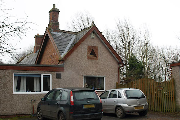 BUF32.jpg Old Station House. (taken 11.3.2011) 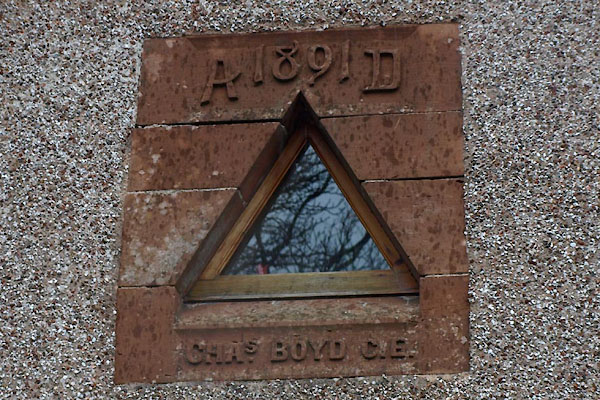 BUF33.jpg Date stone:- "A 1891 D / CHAS. BOYD C.E." (taken 11.3.2011) |
||
|
|
||
| evidence:- | old map:- OS County Series (Cmd 15 16) item:- railway milepost; railway bridge |
|
| source data:- | Maps, County Series maps of Great Britain, scales 6 and 25
inches to 1 mile, published by the Ordnance Survey, Southampton,
Hampshire, from about 1863 to 1948.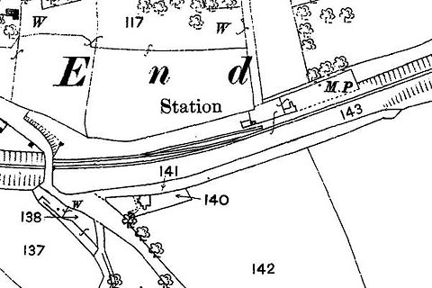 click to enlarge click to enlargeCSRY0019.jpg "Station / M.P." |
|
|
|
||
 Lakes Guides menu.