 Old Cumbria Gazetteer
 |
 |
|
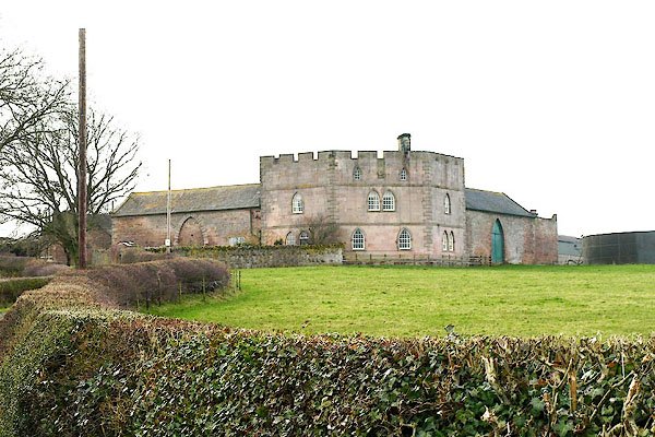
| Bunkers Hill, Dacre | ||
| Bunkers Hill | ||
| Bunkers Hill Farm | ||
| civil parish:- | Dacre (formerly Cumberland) | |
| county:- | Cumbria | |
| locality type:- | buildings | |
| locality type:- | folly | |
| coordinates:- | NY45843087 | |
| 1Km square:- | NY4530 | |
| 10Km square:- | NY43 | |
|
|
||
 BQG01.jpg (taken 14.3.2009) |
||
|
|
||
| evidence:- | old map:- OS County Series (Cmd 58 2) placename:- Bunkers Hill |
|
| source data:- | Maps, County Series maps of Great Britain, scales 6 and 25
inches to 1 mile, published by the Ordnance Survey, Southampton,
Hampshire, from about 1863 to 1948. |
|
|
|
||
| evidence:- | database:- Listed Buildings 2010 placename:- Bunkers Hill item:- date stone (1775) |
|
| source data:- | courtesy of English Heritage "BUNKERS HILL AND BARNS/BYRES ADJOINING / / / DACRE / EDEN / CUMBRIA / II / 73779 / NY4584430876" |
|
|
|
||
| hearsay:- |
The name is in memory the Battle of Bunkers Hill, in the United States, in which a
member of the Howard Family fought. |
|
|
|
||
 Lakes Guides menu.