 |
 |
   |
|
|
|
Buckbarrow |
| locality:- |
Wasdale |
| civil parish:- |
Nether Wasdale (formerly Cumberland) |
| county:- |
Cumbria |
| locality type:- |
hill |
| coordinates:- |
NY134059 |
| 1Km square:- |
NY1305 |
| 10Km square:- |
NY10 |
|
|
|
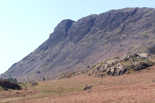
BMB66.jpg (taken 11.5.2006)
|
|
|
| evidence:- |
outline view:- Otley 1823 (4th edn 1830)
placename:- Buckbarrow Pike
|
| source data:- |
Print, engraving, outline view, Mountains round Wastwater as seen from the Strands
in Nether Wasdale, published by Jonathan Otley, Keswick, Cumberland et al, 1830.
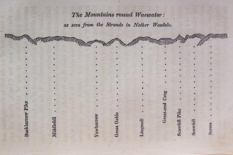 click to enlarge click to enlarge
O75E08.jpg
p.129 in A Concise Description of the English Lakes, by Jonathan Otley, 4th edition,
1830. "The Mountains round Wastwater: / as seen from the Strands in Nether Wasdale."
"Buckbarrow Pike / Middlefell / Yewbarrow / Great Gable / Lingmell / Great-end Crag
/ Scawfell Pike / Scawfell / Screes"
item:- Armitt Library : A1175.8
Image © see bottom of page
|
|
|
| evidence:- |
outline view:- Otley 1823 (5th edn 1834)
placename:- Buckbarrow Pike
|
| source data:- |
Print, woodcut outline view, Mountains of Wast Water, by
Jonathan Otley, Keswick, Cumberland, 1830.
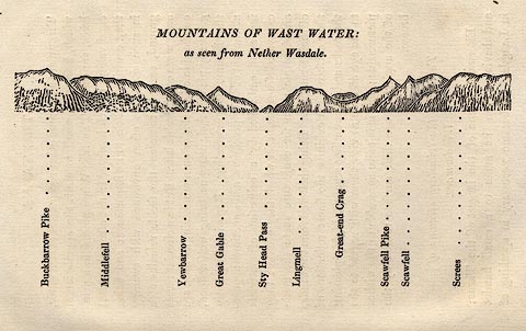 click to enlarge click to enlarge
OT2E07.jpg
Printed on p.31 of A Concise Description of the English Lakes, by Jonathan Otley,
5th edition, 1834. "THE MOUNTAINS OF WAST WATER: as seen from Nether Wasdale."
"Buckbarrow Pike / Middlefell / Yewbarrow / Great Gable / Sty Head Pass / Lingmell
/ Great-end Crag / Scawfell Pike / Scawfell / Screes"
item:- JandMN : 48.8
Image © see bottom of page
|
|
|
| evidence:- |
outline view:- Otley 1823 (8th edn 1849)
placename:- Buckbarrow
placename:- Buckbarrow Pike
|
| source data:- |
Engraving, outline view of mountains, Mountains of Wast Water as seen from Nether
Wasdale, drawn by T Binns, engraved by O Jewitt, opposite p.22 of A Descriptive Guide
of the English Lakes, by Jonathan Otley, 8th edition, 1849.
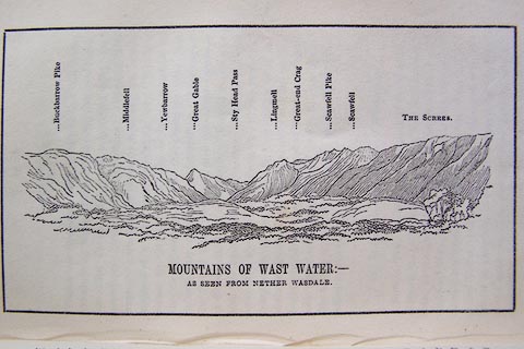 click to enlarge click to enlarge
O80E13.jpg
item:- Armitt Library : A1180.14
Image © see bottom of page
|
|
|
| evidence:- |
outline view:- Seascale 1920s-30s
placename:- Buckbarrow Crag
|
| source data:- |
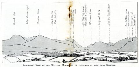
Print, uncoloured engraving, outline view, mountains from Seascale, published by Edward
Burrow and Son, Cheltenham, Gloucestershire, 1920s-30s.
 click to enlarge click to enlarge
SES113.jpg
"PANORAMIC VIEW OF THE WESTERN MOUNTAINS OF LAKELAND AS SEEN FROM SEASCALE."
"... Buckbarrow Crag 1908 ..."
item:- JandMN : 1079.13
Image © see bottom of page
|
|
|
| evidence:- |
outline view:- Black 1856 (23rd edn 1900)
placename:- Buckbarrow Pike
|
| source data:- |
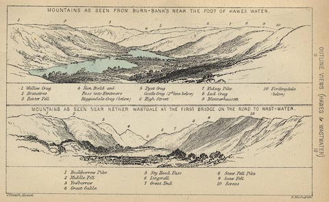
Print, lithograph, Outline Views, Haws and Wastwater - Mountains as seen from Burn-Banks
near the Foot of Hawes Water, and Mountains as seen near Nether Wastdale at the First
Bridge on the road to Wast-Water, by J Flintoft, Keswick, Cumberland, engraved by
R Mason, Edinburgh, Lothian, about 1900.
 click to enlarge click to enlarge
BC08E6.jpg
"... 1 Buckbarrow Pike ..."
item:- JandMN : 37.21
Image © see bottom of page
|
|
|
| evidence:- |
outline view:- Linton 1852
placename:- Buckbarrow
|
| source data:- |
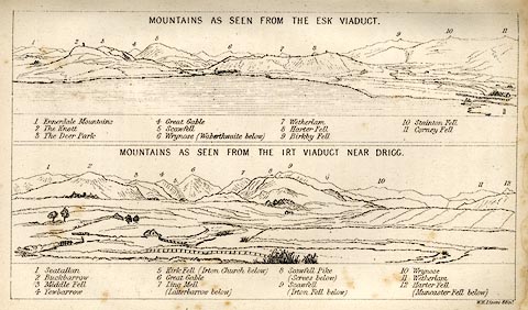
Print, engraving, outline views, Mountains as Seen from the Esk Viaduct, the Eskmeals
Viaduct, and Mountains as Seen from the Viaduct near Drigg, the Irt Viaduct, Whitehaven
and Furness Junction Railway, Cumberland, engraved by W H Lizars, Edinburgh, published
by Whittaker and Co, London, and by R Gibson and Son and by Callander and Dixon, Whitehaven,
Cumberland, 1852.
 click to enlarge click to enlarge
LN1E13.jpg
Tipped in opposite p.86 of A Handbook of the Whitehaven and Furness Railway, by John
Linton.
item:- Armitt Library : A1158.11
Image © see bottom of page
|
|
|
| evidence:- |
outline view:- Black 1841 (3rd edn 1846)
placename:- Buckbarrow Pike
|
| source data:- |
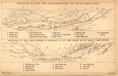
Print, engraving, outline view, Mountains as seen from Burn Banks near the Foot of
Hawes Water, and Mountains as seen near Strands in Wastdale at the First bridge on
the Road to Wast Water, by J Flintoft, Keswick, Cumberland, engraved by R Mason, Edinburgh,
Lothian, about 1846.
 click to enlarge click to enlarge
BC02E8.jpg
"... 1 Buckbarrow Pike ..."
item:- JandMN : 32.12
Image © see bottom of page
|
|
|


 click to enlarge
 click to enlarge
 click to enlarge
 click to enlarge
 click to enlarge
 click to enlarge
 click to enlarge
 Lakes Guides menu.