 Old Cumbria Gazetteer
 |
 |
|
| Brunsow Beck | ||
| runs into:- |  Irish Sea Irish Sea |
|
|
|
||
| Mark Beck | ||
| civil parish:- | Crosscanonby (formerly Cumberland) | |
| civil parish:- | Oughterside and Allerby (formerly Cumberland) | |
| county:- | Cumbria | |
| locality type:- | river | |
| locality type:- | boundary | |
| locality type:- | parish boundary | |
| 1Km square:- | NY0839 (etc) | |
| 10Km square:- | NY03 | |
|
|
||
| evidence:- | old map:- OS County Series (Cmd 35 14) placename:- Brunsow Beck |
|
| source data:- | Maps, County Series maps of Great Britain, scales 6 and 25
inches to 1 mile, published by the Ordnance Survey, Southampton,
Hampshire, from about 1863 to 1948. |
|
|
|
||
| evidence:- | old map:- Pelin c1700 placename:- Mark Beck |
|
| source data:- | Map, manuscript, 'Elnefoot' area north of Maryport, Oughterside
and Allerby, Cumberland, by Andrew Pelin, Whitehaven,
Cumberland, about 1700. image courtesy of Carlisle Record Office 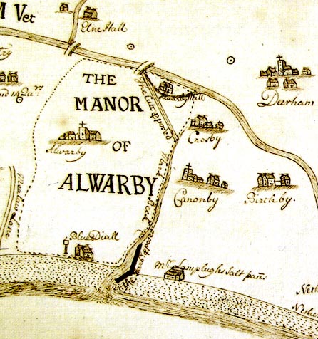 PR0785.jpg "Mark Beck" item:- CarlisleRO : D/Lons/W10/fol 22 Image © Carlisle Record Office |
|
|
|
||
Lakes Guides menu.