 Old Cumbria Gazetteer
 |
 |
|
| Brown Pike, Dunnerdale-with-Seathwaite | ||
| Brown Pike | ||
| locality:- | Old Man of Coniston | |
| civil parish:- | Dunnerdale-with-Seathwaite (formerly Lancashire) | |
| civil parish:- | Torver (formerly Lancashire) | |
| county:- | Cumbria | |
| locality type:- | hill | |
| coordinates:- | SD26069660 | |
| 1Km square:- | SD2696 | |
| 10Km square:- | SD29 | |
| altitude:- | 2238 feet | |
| altitude:- | 682m | |
|
|
||
| evidence:- | outline view:- Otley 1823 (8th edn 1849) placename:- Brown Pike |
|
| source data:- | Engraving, outline view of mountains, Coniston Water from near Bank Ground, drawn
by T Binns, engraved by O Jewitt, opposite p.8 of A Descriptive Guide of the English
Lakes, by Jonathan Otley, 8th edition, 1849.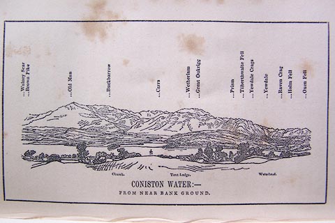 click to enlarge click to enlargeO80E05.jpg item:- Armitt Library : A1180.6 Image © see bottom of page |
|
|
|
||
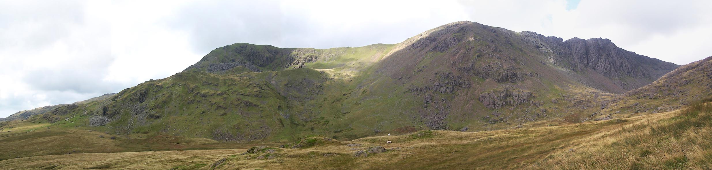 Click to enlarge BTN38.jpg Brown Pike, Buck Pike, Dow Crags. (taken 8.9.2010) |
||
|
|
||
 Lakes Guides menu.