 Old Cumbria Gazetteer
 |
 |
|
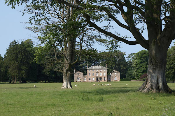
| Broughton Lodge, Broughton East | ||
| Broughton Lodge | ||
| civil parish:- | Broughton East (formerly Lancashire) | |
| county:- | Cumbria | |
| locality type:- | buildings | |
| coordinates:- | SD39158081 | |
| 1Km square:- | SD3980 | |
| 10Km square:- | SD38 | |
|
|
||
 BYS54.jpg (taken 5.7.2013)  BYS55.jpg (taken 5.7.2013) |
||
|
|
||
| evidence:- | old map:- OS County Series (Lan 12 11) placename:- Broughton Lodge |
|
| source data:- | Maps, County Series maps of Great Britain, scales 6 and 25
inches to 1 mile, published by the Ordnance Survey, Southampton,
Hampshire, from about 1863 to 1948. |
|
|
|
||
| evidence:- | database:- Listed Buildings 2010 placename:- Broughton Lodge |
|
| source data:- | courtesy of English Heritage "BROUGHTON LODGE / / / BROUGHTON EAST / SOUTH LAKELAND / CUMBRIA / II / 76923 / SD3915780816" |
|
|
|
||
| evidence:- | database:- Listed Buildings 2010 |
|
| source data:- | courtesy of English Heritage "FORMER STABLES APPROXIMATELY 50 METRES TO EAST OF BROUGHTON LODGE / / / BROUGHTON EAST / SOUTH LAKELAND / CUMBRIA / II / 76924 / SD3922680803" |
|
|
|
||
 Lakes Guides menu.