 Old Cumbria Gazetteer
 |
 |
|
| Brotherilkeld, Eskdale | ||
| Brotherilkeld | ||
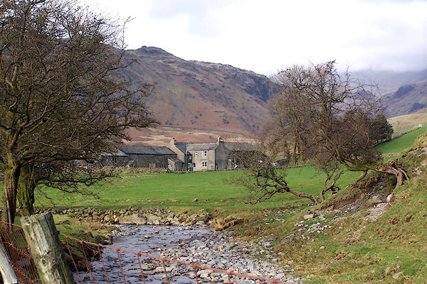
| Brotherilkeld Farm | ||
| locality:- | Eskdale | |
| civil parish:- | Eskdale (formerly Cumberland) | |
| county:- | Cumbria | |
| locality type:- | buildings | |
| coordinates:- | NY21270143 | |
| 1Km square:- | NY2101 | |
| 10Km square:- | NY20 | |
|
|
||
 BNJ60.jpg (taken 14.3.2007) 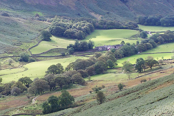 BRM36.jpg (taken 14.9.2009) |
||
|
|
||
| evidence:- | old map:- Donald 1774 (Cmd) placename:- Butter Ilket |
|
| source data:- | Map, hand coloured engraving, 3x2 sheets, The County of Cumberland, scale about 1
inch to 1 mile, by Thomas Donald, engraved and published by Joseph Hodskinson, 29
Arundel Street, Strand, London, 1774.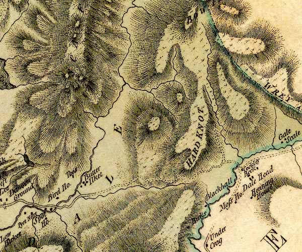 D4NY20SW.jpg "Butter Ilket" block or blocks, labelled in lowercase; a hamlet or just a house item:- Carlisle Library : Map 2 Image © Carlisle Library |
|
|
|
||
| evidence:- | database:- Listed Buildings 2010 placename:- Brotherilkeld Farm |
|
| source data:- | courtesy of English Heritage "BROTHERILKELD FARMHOUSE WITH ADJOINING STABLE AND BARN / / / ESKDALE / COPELAND / CUMBRIA / II / 437217 / NY2129001412" |
|
|
|
||
 Lakes Guides menu.