 Old Cumbria Gazetteer
 |
 |
|
| bridge, Howtown | ||
| site name:- | Fusedale Beck | |
| locality:- | Howtown | |
| civil parish:- | Martindale (formerly Westmorland) | |
| county:- | Cumbria | |
| locality type:- | bridge | |
| coordinates:- | NY44331964 | |
| 1Km square:- | NY4419 | |
| 10Km square:- | NY41 | |
|
|
||
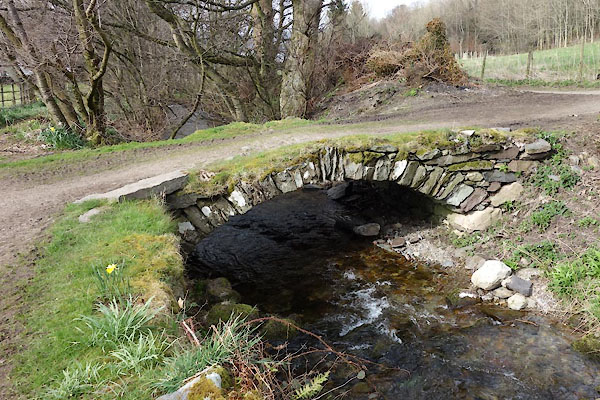 CCV19.jpg (taken 8.4.2015) |
||
|
|
||
| evidence:- | probably old map:- Donald 1774 (Cmd) |
|
| source data:- | Map, hand coloured engraving, 3x2 sheets, The County of Cumberland, scale about 1
inch to 1 mile, by Thomas Donald, engraved and published by Joseph Hodskinson, 29
Arundel Street, Strand, London, 1774.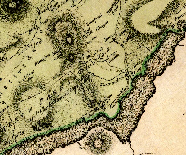 D4NY42SW.jpg double line across a river; a bridge at Howtown item:- Carlisle Library : Map 2 Image © Carlisle Library |
|
|
|
||
| evidence:- | database:- Listed Buildings 2010 |
|
| source data:- | courtesy of English Heritage "BRIDGE IMMEDIATELY NORTH EAST OF HOWTOWN HOUSE / / / MARTINDALE / EDEN / CUMBRIA / II / 74538 / NY4433719645" |
|
| source data:- | courtesy of English Heritage "Bridge. Probably C18. Stone rubble. Segmental arch and abutments, no parapets." |
|
|
|
||
 Lakes Guides menu.