 Old Cumbria Gazetteer
 |
 |
|
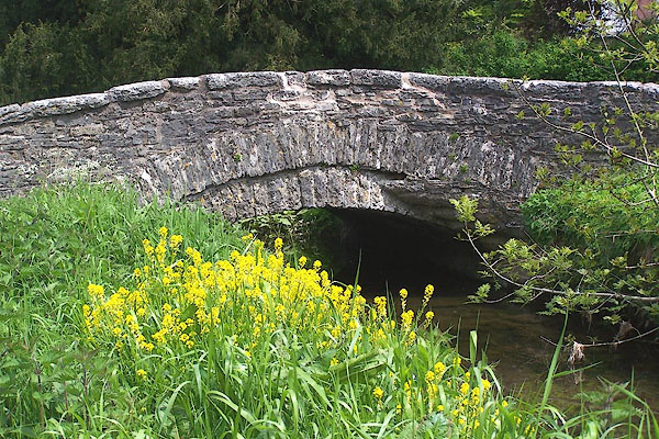
| New Bridge, Crosby Ravensworth | ||
| New Bridge | ||
| site name:- | Dalebanks Beck | |
| locality:- | Crosby Ravensworth | |
| civil parish:- | Crosby Ravensworth (formerly Westmorland) | |
| county:- | Cumbria | |
| locality type:- | bridge | |
| coordinates:- | NY62211484 | |
| 1Km square:- | NY6214 | |
| 10Km square:- | NY61 | |
|
|
||
 BME43.jpg (taken 30.5.2006) |
||
|
|
||
| evidence:- | old map:- OS County Series (Wmd 14 16) placename:- New Bridge |
|
| source data:- | Maps, County Series maps of Great Britain, scales 6 and 25
inches to 1 mile, published by the Ordnance Survey, Southampton,
Hampshire, from about 1863 to 1948. |
|
|
|
||
| evidence:- | database:- Listed Buildings 2010 |
|
| source data:- | courtesy of English Heritage "ROADBRIDGE OVER DALESBANK BECK TO SOUTH EAST OF CHURCH / / / CROSBY RAVENSWORTH / EDEN / CUMBRIA / II / 74031 / NY6221514837" |
|
| source data:- | courtesy of English Heritage "Roadbridge. Probably C18 but perhaps earlier. Coursed rubble. Single segmental arch spanning c.15 ft. Roadway is c.12 ft wide; parapets are c.2 1/2 ft high with splayed ends and flat, rough-dressed copings." |
|
|
|
||
 Lakes Guides menu.