 Old Cumbria Gazetteer
 |
 |
|
| Bridge End, Firbank | ||
| Bridge End | ||
| Lincoln's Inn Bridge Farm | ||
| civil parish:- | Firbank (formerly Westmorland) | |
| county:- | Cumbria | |
| locality type:- | buildings | |
| locality type:- | inn (ex) | |
| coordinates:- | SD63119230 | |
| 1Km square:- | SD6392 | |
| 10Km square:- | SD69 | |
|
|
||
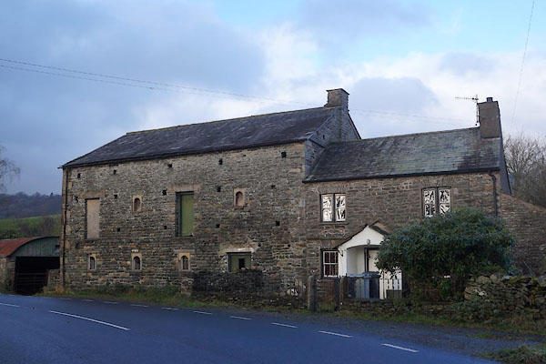 CCD49.jpg (taken 28.11.2014) 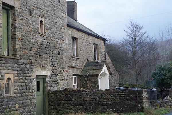 CCD50.jpg (taken 28.11.2014) |
||
|
|
||
| evidence:- | old map:- OS County Series (Wmd 40 5) placename:- Bridge End |
|
| source data:- | Maps, County Series maps of Great Britain, scales 6 and 25
inches to 1 mile, published by the Ordnance Survey, Southampton,
Hampshire, from about 1863 to 1948. |
|
|
|
||
| evidence:- | old map:- Jefferys 1770 (Wmd) placename:- Bridge End |
|
| source data:- | Map, 4 sheets, The County of Westmoreland, scale 1 inch to 1
mile, surveyed 1768, and engraved and published by Thomas
Jefferys, London, 1770.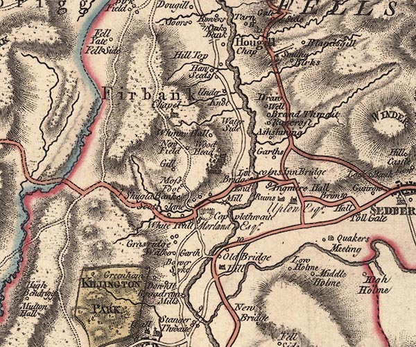 J5SD69SW.jpg "Bridge End" circle, labelled in italic lowercase text; settlement, farm, house, or hamlet? item:- National Library of Scotland : EME.s.47 Image © National Library of Scotland |
|
|
|
||
| evidence:- | database:- Listed Buildings 2010 placename:- Bridge End |
|
| source data:- | courtesy of English Heritage "BRIDGE END AND ATTACHED BARN / / A684 / FIRBANK / SOUTH LAKELAND / CUMBRIA / II / 75640 / SD6311092300" |
|
|
|
||
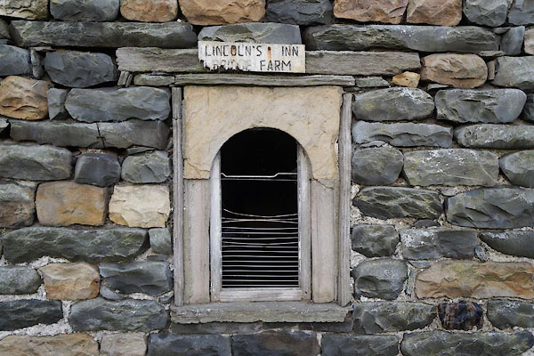 CCD51.jpg Window, and sign. (taken 28.11.2014) |
||
| The farm named after the bridge, which is named after the inn which the farm once
was, which was named after Mr Lincoln. |
||
|
|
||
 Lakes Guides menu.