 Old Cumbria Gazetteer
 |
 |
|
| Brathay Garths, Brathay | ||
| Brathay Garths | ||
| locality:- | Brathay | |
| civil parish:- | Skelwith (formerly Lancashire) | |
| county:- | Cumbria | |
| locality type:- | wood | |
| coordinates:- | NY366026 | |
| 1Km square:- | NY3602 | |
| 10Km square:- | NY30 | |
|
|
||
| evidence:- | probably old map:- Saxton 1579 |
|
| source data:- | Map, hand coloured engraving, Westmorlandiae et Cumberlandiae Comitatus ie Westmorland
and Cumberland, scale about 5 miles to 1 inch, by Christopher Saxton, London, engraved
by Augustinus Ryther, 1576, published 1579-1645.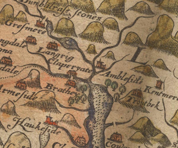 Sax9NY30.jpg item:- private collection : 2 Image © see bottom of page |
|
|
|
||
| evidence:- | old map:- Clarke 1787 map (Windermere N) placename:- Brathay Wood |
|
| source data:- | Map, A Map of the Northern Part of the Lake Winandermere and its
Environs, scale about 6.5 ins to 1 mile, by James Clarke,
engraved by Samuel John Neele, 352 Strand, published by James
Clarke, Penrith, Cumberland and in London etc, 1787.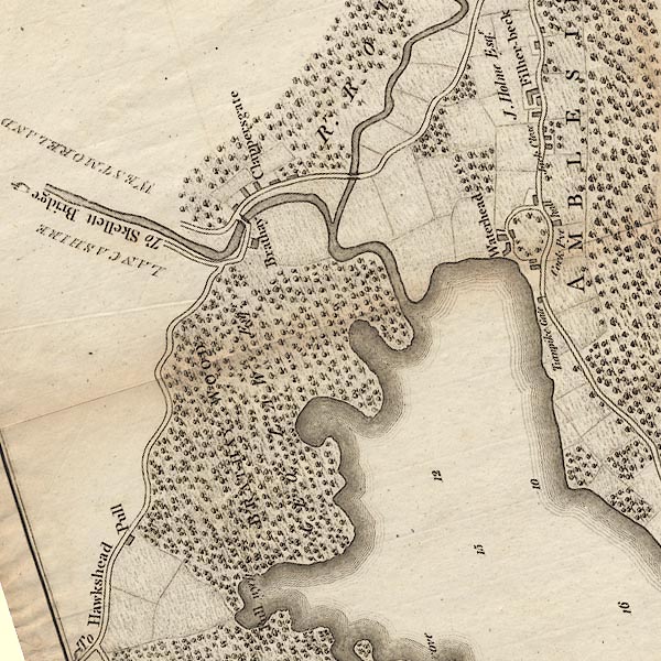 CLANY30R.jpg "BRATHAY WOOD / GEO. LAW Esqr." item:- private collection : 10.10 Image © see bottom of page |
|
|
|
||
 Lakes Guides menu.