 Old Cumbria Gazetteer
 |
 |
|
| Branthwaite Station, Branthwaite | ||
| gone | ||
| Branthwaite Station | ||
| site name:- | Whitehaven, Cleator and Egremont Railway | |
| locality:- | Branthwaite | |
| civil parish:- | Dean (formerly Cumberland) | |
| county:- | Cumbria | |
| locality type:- | railway station | |
| coordinates:- | NY05932514 | |
| 1Km square:- | NY0525 | |
| 10Km square:- | NY02 | |
| SummaryText:- | Opened 1866; closed 1931. | |
|
|
||
| evidence:- | old map:- OS County Series (Cmd 62 1) |
|
| source data:- | Maps, County Series maps of Great Britain, scales 6 and 25
inches to 1 mile, published by the Ordnance Survey, Southampton,
Hampshire, from about 1863 to 1948.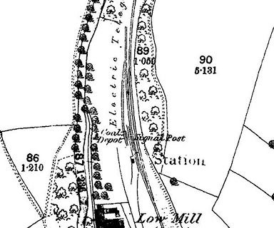 click to enlarge click to enlargeCSRY0084.jpg "Station / Coal Depot / Signal Post" |
|
|
|
||
 Lakes Guides menu.