 Old Cumbria Gazetteer
 |
 |
|
| Bowland Bridge, Bowland Bridge | ||
| Bowland Bridge | ||
| site name:- | Winster, River | |
| locality:- | Bowland Bridge | |
| civil parish:- | Crosthwaite and Lyth (formerly Westmorland) | |
| county:- | Cumbria | |
| locality type:- | bridge | |
| locality type:- | boundary stone | |
| locality type:- | parish boundary mark | |
| locality type:- | county boundary mark (old) | |
| coordinates:- | SD41718955 | |
| 1Km square:- | SD4189 | |
| 10Km square:- | SD48 | |
| civil parish:- | Cartmel Fell (formerly Lancashire) | |
| county:- | Cumbria | |
|
|
||
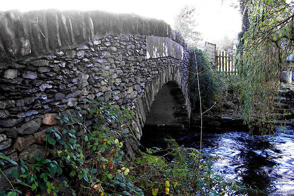 BJZ56.jpg (taken 9.11.2005) 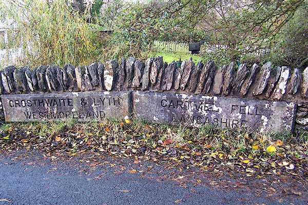 BJZ57.jpg "CROSTHWAITE &LYTH WESTMORELAND / CARTMEL FELL LANCASHIRE" (taken 9.11.2005) |
||
|
|
||
| evidence:- | old map:- OS County Series (Wmd 37 16) placename:- Bowland Bridge |
|
| source data:- | Maps, County Series maps of Great Britain, scales 6 and 25
inches to 1 mile, published by the Ordnance Survey, Southampton,
Hampshire, from about 1863 to 1948. |
|
|
|
||
| evidence:- | old map:- OS County Series (Lan 8 8) placename:- Bowland Bridge |
|
| source data:- | Maps, County Series maps of Great Britain, scales 6 and 25
inches to 1 mile, published by the Ordnance Survey, Southampton,
Hampshire, from about 1863 to 1948. |
|
|
|
||
| evidence:- | old map:- Jefferys 1770 (Wmd) placename:- Bouland Bridge |
|
| source data:- | Map, 4 sheets, The County of Westmoreland, scale 1 inch to 1
mile, surveyed 1768, and engraved and published by Thomas
Jefferys, London, 1770.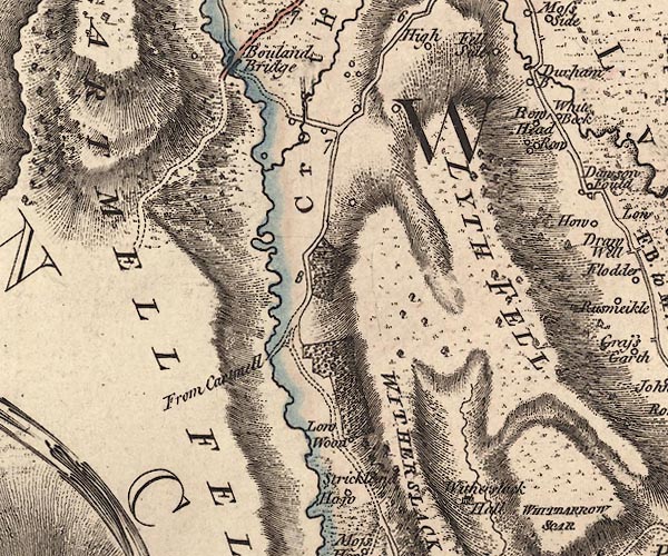 J5SD48NW.jpg "Bouland Bridge" double line, road, across a stream; bridge item:- National Library of Scotland : EME.s.47 Image © National Library of Scotland |
|
|
|
||
| evidence:- | old map:- Cary 1789 (edn 1805) placename:- Bouland Bridge |
|
| source data:- | Map, uncoloured engraving, Westmoreland, scale about 2.5 miles
to 1 inch, by John Cary, London, 1789; edition 1805. CY24SD48.jpg "Bouland Br." road across a stream; bridge over the Winster item:- JandMN : 129 Image © see bottom of page |
|
|
|
||
| evidence:- | old map:- Garnett 1850s-60s H placename:- Bowland Bridge |
|
| source data:- | Map of the English Lakes, in Cumberland, Westmorland and
Lancashire, scale about 3.5 miles to 1 inch, published by John
Garnett, Windermere, Westmorland, 1850s-60s.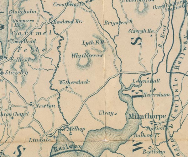 GAR2SD48.jpg "Bowland Br." road crosses stream item:- JandMN : 82.1 Image © see bottom of page |
|
|
|
||
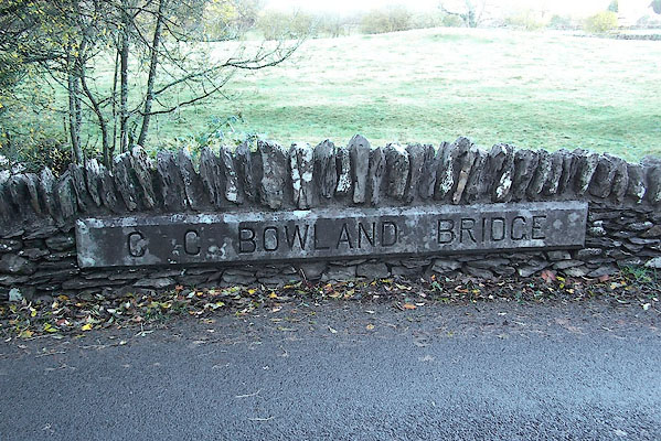 BJZ58.jpg "C C BOWLAND BRIDGE" (taken 9.11.2005) |
||
|
|
||
 Lakes Guides menu.