 Old Cumbria Gazetteer
 |
 |
|
| boundary stone, Garsdale | ||
| civil parish:- | Garsdale (formerly Yorkshire) | |
| county:- | Cumbria | |
| locality type:- | boundary stone | |
| locality type:- | county boundary mark | |
| coordinates:- | SD79399256 | |
| 1Km square:- | SD7992 | |
| 10Km square:- | SD79 | |
| county:- | North Yorkshire | |
| current boundary | ||
| locality:- | Cumbria boundary | |
|
|
||
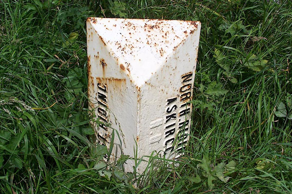 BJR70.jpg Cast iron boundary marker by the Kendal to Hawes road, A684 "WEST RIDING / NORTH RIDING ASKRIGG" This part of the West Riding is now Cumbria. (taken 9.8.2005) |
||
|
|
||
 Lakes Guides menu.