 Old Cumbria Gazetteer
 |
 |
|
| boundary stone, Mallerstang/Nateby | ||
| civil parish:- | Mallerstang (formerly Westmorland) | |
| civil parish:- | Nateby (formerly Westmorland) | |
| county:- | Cumbria | |
| locality type:- | boundary stone | |
| locality type:- | parish boundary mark | |
| coordinates:- | NY77740464 | |
| 1Km square:- | NY7704 | |
| 10Km square:- | NY70 | |
|
|
||
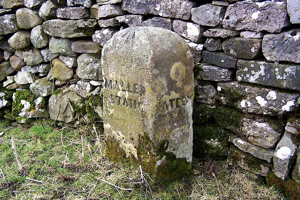 BLQ35.jpg Inscribed stone:- "MALLE[ ] STAN[ ] / [ ]ATEBY" and a cut bench mark (taken 25.2.2006) |
||
|
|
||
| evidence:- | database:- Listed Buildings 2010 |
|
| source data:- | courtesy of English Heritage "BOUNDARY STONE TO EAST OF WHITE BRACKENS HOUSE (NATEBY PARISH) / / B6259 (NORTH OF OUTHGILL) / MALLERSTANG / EDEN / CUMBRIA / II / 73363 / NY7774904651" |
|
| source data:- | courtesy of English Heritage "Boundary marker, probably mid Cl9. Single stone c3 ft high, rectangular in plan with domical top. South face painted white with MALLERSTAND carved in sans-serif lettering picked out in black; bench mark at top. East face unpainted with NATEBY carved in sans-serif lettering." |
|
|
|
||
 Lakes Guides menu.