 Old Cumbria Gazetteer
 |
 |
|
| boundary stone, Longsleddale/Whitwell etc | ||
| locality:- | boundary, Longsleddale/Whitwell and Selside | |
| locality:- | Longsleddale | |
| civil parish:- | Longsleddale (formerly Westmorland) | |
| civil parish:- | Whitwell and Selside (formerly Westmorland) | |
| county:- | Cumbria | |
| locality type:- | boundary stone | |
| locality type:- | parish boundary mark | |
| coordinates:- | NY51800003 | |
| 1Km square:- | NY5100 | |
| 10Km square:- | NY50 | |
|
|
||
 BIP30.jpg (taken 22.4.2004) |
||
|
|
||
| evidence:- | old map:- OS County Series (Wmd 33 4) |
|
| source data:- | Maps, County Series maps of Great Britain, scales 6 and 25
inches to 1 mile, published by the Ordnance Survey, Southampton,
Hampshire, from about 1863 to 1948. The boundary crosses the road here; it continues south east along the road side for a way. |
|
|
|
||
| evidence:- | map:- OS Six Inch (1956) |
|
| source data:- | Map series, various editions with the national grid, scale about
6 inches to 1 mile, published by the Ordnance Survey,
Southampton, Hampshire, scale 1 to 10560 from 1950s to 1960s,
then 1 to 10000 from 1960s to 2000s, superseded by print on
demand from digital data.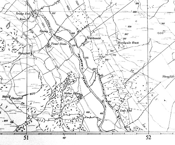 SINY5100.jpg "B.S." |
|
|
|
||
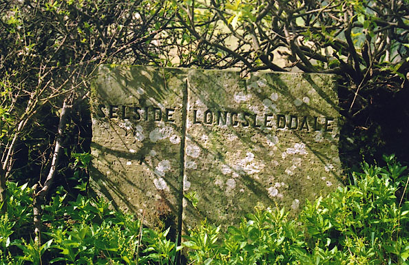
| :- |
Stone slab in the hedgerow, marked with a vertical line, lettered:- |
|
| "SELSIDE / LONGSLEDDALE" |
||
| The present day (2004) civil parish adjoining Longsleddale here is Whitwell and Selside. |
||
|
|
||
| :- |
When signposts and suchlike were removed during World War II, this boundary stone
was removed too. It was placed, face down, over a water tank at Dale End by Geoff
Waine. It was only by luck that someone asked him about it after the war so that it
was rediscovered. |
|
| Waine, Geoff: 28.3.2004: conversation |
||
|
|
||
 Lakes Guides menu.