 Old Cumbria Gazetteer
 |
 |
|
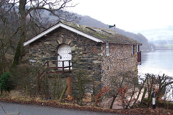
| boat house, Dacre | ||
| site name:- | Ullswater | |
| civil parish:- | Dacre (formerly Cumberland) | |
| county:- | Cumbria | |
| locality type:- | boat house | |
| coordinates:- | NY46182421 | |
| 1Km square:- | NY4624 | |
| 10Km square:- | NY42 | |
| references:- | Crosthwaite 1783-94 |
|
|
|
||
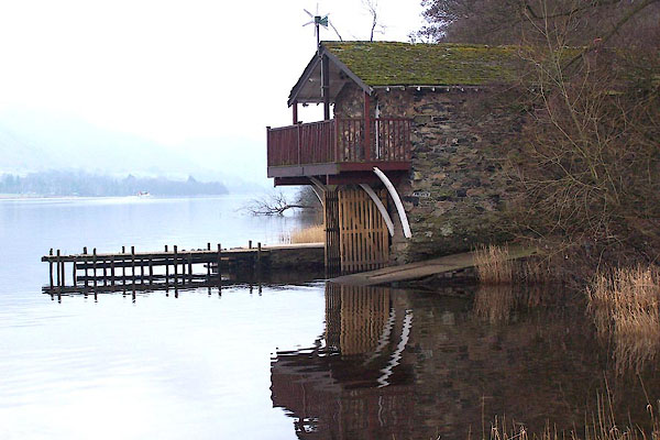 BLO05.jpg (taken 4.1.2006) 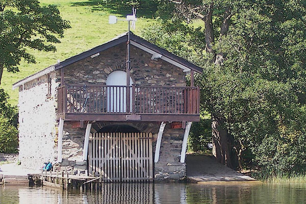 BNZ63.jpg (taken 24.8.2007) |
||
|
|
||
| evidence:- | old map:- OS County Series (Cmd 66 2) |
|
| source data:- | Maps, County Series maps of Great Britain, scales 6 and 25
inches to 1 mile, published by the Ordnance Survey, Southampton,
Hampshire, from about 1863 to 1948. "Boat House" |
|
|
|
||
| evidence:- | old map:- Crosthwaite 1783-94 (Ull) placename:- Duke of Portland's Boat House |
|
| source data:- | Map, uncoloured engraving, Accurate Map of the Beautiful Lake of
Ullswater, scale about 3 inches to 1 mile, by Peter Crosthwaite,
Keswick, Cumberland, 1783, version published 1800.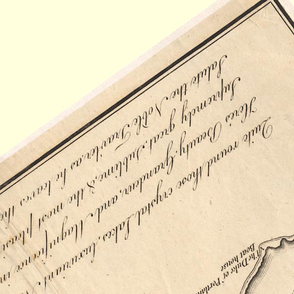 CT5NY42M.jpg "The Duke of Portland's Boat house" item:- Armitt Library : 1959.191.7 Image © see bottom of page |
|
|
|
||
| evidence:- | old map:- Clarke 1787 map (Ullswater) |
|
| source data:- | Map, A Map of the Lake Ullswater and its Environs, scale about
6.5 ins to 1 mile, by James Clarke, engraved by S J Neele, 352
Strand, published by James Clarke, Penrith, Cumberland and in
London etc, 1787.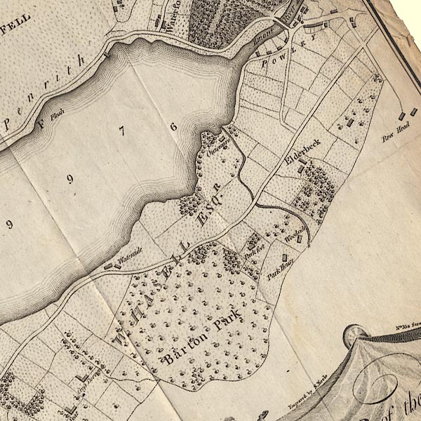 CL4NY42R.jpg Drawn out into the lake. item:- private collection : 10.4 Image © see bottom of page |
|
|
|
||
 BLO07.jpg (taken 4.1.2006) |
||
|
|
||
 Lakes Guides menu.