 Old Cumbria Gazetteer
 |
 |
|
| Blelham Tarn, Hawkshead | ||
| Blelham Tarn | ||
| civil parish:- | Hawkshead (formerly Lancashire) | |
| civil parish:- | Claife (formerly Lancashire) | |
| county:- | Cumbria | |
| locality type:- | tarn | |
| coordinates:- | NY365004 | |
| 1Km square:- | NY3600 | |
| 10Km square:- | NY30 | |
| altitude:- | 138 feet | |
| altitude:- | 43m | |
|
|
||
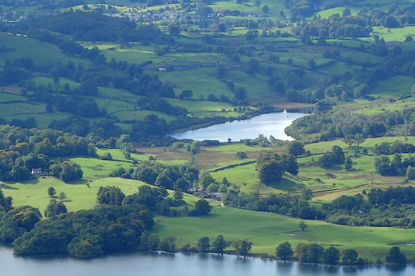
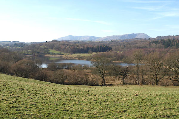 BOR14.jpg From Low Wray. (taken 15.2.2008) 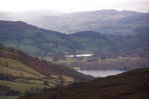 BLK61.jpg Blelham Tarn, behind Windermere, from Kirkstone. (taken 5.12.2005) |
||
|
|
||
| evidence:- | old map:- OS County Series (Lan 2 10) placename:- Blelham Tarn |
|
| source data:- | Maps, County Series maps of Great Britain, scales 6 and 25
inches to 1 mile, published by the Ordnance Survey, Southampton,
Hampshire, from about 1863 to 1948. |
|
|
|
||
| evidence:- | old map:- Seller 1694 (Wmd) |
|
| source data:- | Map, hand coloured engraving, Westmorland, scale about 8 miles
to 1 inch, by John Seller, 1694. click to enlarge click to enlargeSEL7.jpg outline with shaded shore; lake item:- Dove Cottage : 2007.38.87 Image © see bottom of page |
|
|
|
||
| evidence:- | old map:- Jefferys 1770 (Wmd) placename:- Blelham Tarn |
|
| source data:- | Map, 4 sheets, The County of Westmoreland, scale 1 inch to 1
mile, surveyed 1768, and engraved and published by Thomas
Jefferys, London, 1770.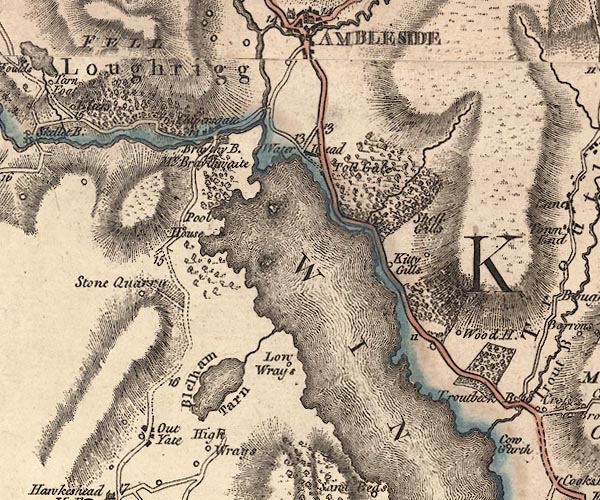 J5NY30SE.jpg "Blelham Tarn" outline with form lines; lake or tarn item:- National Library of Scotland : EME.s.47 Image © National Library of Scotland |
|
|
|
||
| evidence:- | old map:- Crosthwaite 1783-94 (Win/Ble) placename:- Blellam Tarn |
|
| source data:- | Map, uncoloured engraving, An Accurate Map of the Grand Lake of
Windermere, scale about 2 inches to 1 mile, by Peter
Crosthwaite, Keswick, Cumberland, 1783, version published 1819.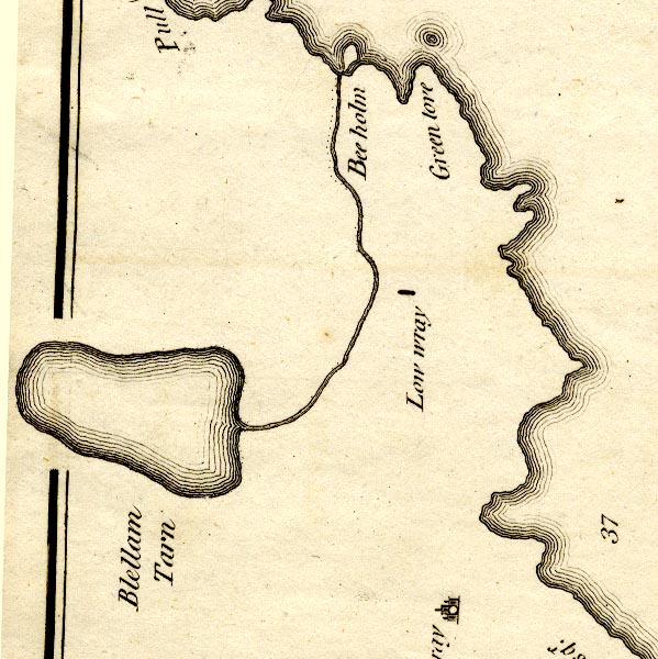 CT9NY30Q.jpg "Blellam Tarn" outline with form lines item:- Armitt Library : 2008.14.102 Image © see bottom of page |
|
|
|
||
| evidence:- | old map:- West 1784 map |
|
| source data:- | Map, hand coloured engraving, A Map of the Lakes in Cumberland,
Westmorland and Lancashire, scale about 3.5 miles to 1 inch,
engraved by Paas, 53 Holborn, London, about 1784.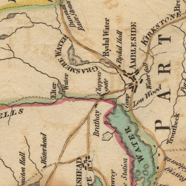 Ws02NY30.jpg item:- Armitt Library : A1221.1 Image © see bottom of page |
|
|
|
||
| evidence:- | old map:- Cary 1789 (edn 1805) placename:- Bletharn Tarn |
|
| source data:- | Map, uncoloured engraving, Westmoreland, scale about 2.5 miles
to 1 inch, by John Cary, London, 1789; edition 1805.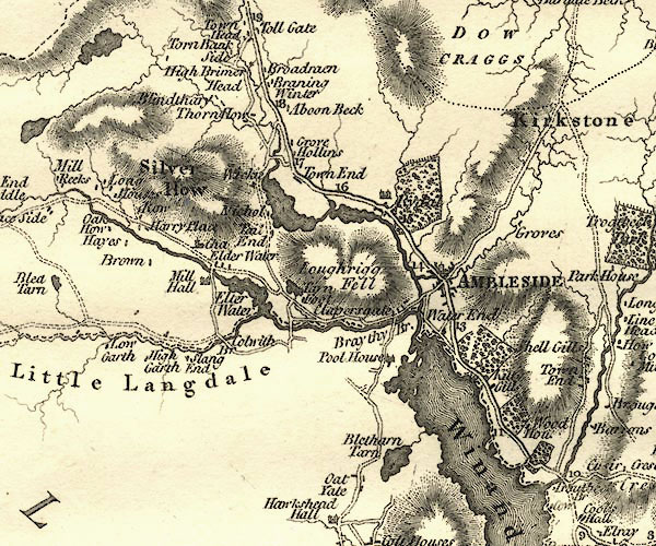 CY24NY30.jpg "Bletharn Tarn" outline with shore form lines; lake or tarn item:- JandMN : 129 Image © see bottom of page |
|
|
|
||
| evidence:- | old map:- Laurie and Whittle 1806 placename:- Blelham Tarn |
|
| source data:- | Road map, Completion of the Roads to the Lakes, scale about 10
miles to 1 inch, by Nathaniel Coltman? 1806, published by Robert
H Laurie, 53 Fleet Street, London, 1834. click to enlarge click to enlargeLw18.jpg "Blelham Tarn" lake item:- private collection : 18.18 Image © see bottom of page |
|
|
|
||
| evidence:- | old map:- Otley 1818 placename:- Blelham |
|
| source data:- | Map, uncoloured engraving, The District of the Lakes,
Cumberland, Westmorland, and Lancashire, scale about 4 miles to
1 inch, by Jonathan Otley, 1818, engraved by J and G Menzies,
Edinburgh, Scotland, published by Jonathan Otley, Keswick,
Cumberland, et al, 1833.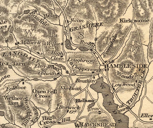 OT02NY30.jpg item:- JandMN : 48.1 Image © see bottom of page |
|
|
|
||
| evidence:- | old map:- Garnett 1850s-60s H placename:- Blelham Tarn |
|
| source data:- | Map of the English Lakes, in Cumberland, Westmorland and
Lancashire, scale about 3.5 miles to 1 inch, published by John
Garnett, Windermere, Westmorland, 1850s-60s.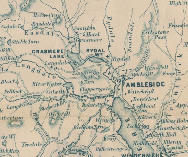 GAR2NY30.jpg "Blelham Tarn" outline with shore form lines, lake or tarn item:- JandMN : 82.1 Image © see bottom of page |
|
|
|
||
| evidence:- | old map:- Prior 1874 map 1 |
|
| source data:- | Map, uncoloured engraving or lithograph? Winander Mere, scale
about 2.5 miles to 1 inch, published by John Garnett,
Windermere, Westmorland, 1874. click to enlarge click to enlargePI03M1.jpg outline with form lines; lake item:- private collection : 133.1 Image © see bottom of page |
|
|
|
||
| evidence:- | old map:- Jenkinson 1875 map1 placename:- |
|
| source data:- | Map, Windermere Section, Westmorland and Lancashire, ?colour
lithograph, scale about 1 mile to 1 inch, by Stanford's
Geographical Establishment, published by Edward Stanford, 55
Charing Cross, London, 1875.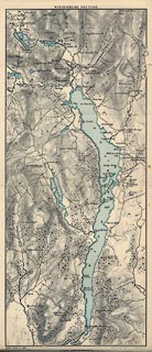 click to enlarge click to enlargeJK04.jpg item:- JandMN : 28.3 Image © see bottom of page |
|
|
|
||
| evidence:- | old photograph:- Bell 1880s-1940s |
|
| source data:- | Photograph, sepia, Blelham Tarn, Hawkshead, Lancashire, by Herbert Bell, Ambleside,
Westmorland, 1890s?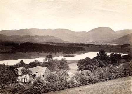 click to enlarge click to enlargeHB0287.jpg item:- Armitt Library : ALPS644 Image © see bottom of page |
|
|
|
||
 CDZ70.jpg from Wansfell. (taken 22.9.2015) 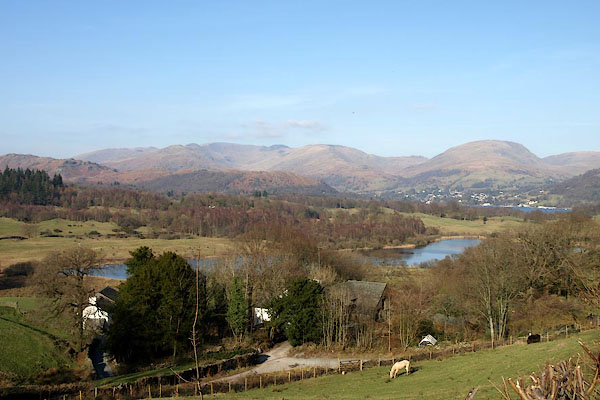 BOR45.jpg (taken 15.2.2008) |
||
|
|
||
 Lakes Guides menu.