Old Cumbria Gazetteer
 |
 |
|
||
| Black Burn (2) | ||||
| runs into:- |  South Tyne, River South Tyne, River |
|||
|
|
||||
| Black Burn | ||||
| civil parish:- | Ousby (formerly Cumberland) | |||
| civil parish:- | Alston Moor (formerly Cumberland) | |||
| county:- | Cumbria | |||
| locality type:- | river | |||
| 1Km square:- | NY6841 | |||
| 10Km square:- | NY64 | |||
| 10Km square:- | NY63 | |||
|
|
||||
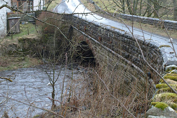
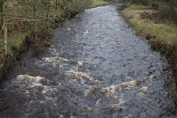 BSJ43.jpg At Blackburn Bridge, (taken 26.3.2010) |
||||
|
|
||||
| evidence:- | old map:- OS County Series (Cmd 41 4) placename:- Black Burn |
|||
| source data:- | Maps, County Series maps of Great Britain, scales 6 and 25
inches to 1 mile, published by the Ordnance Survey, Southampton,
Hampshire, from about 1863 to 1948. |
|||
|
|
||||
| evidence:- | old map:- Saxton 1579 |
|||
| source data:- | Map, hand coloured engraving, Westmorlandiae et Cumberlandiae Comitatus ie Westmorland
and Cumberland, scale about 5 miles to 1 inch, by Christopher Saxton, London, engraved
by Augustinus Ryther, 1576, published 1579-1645.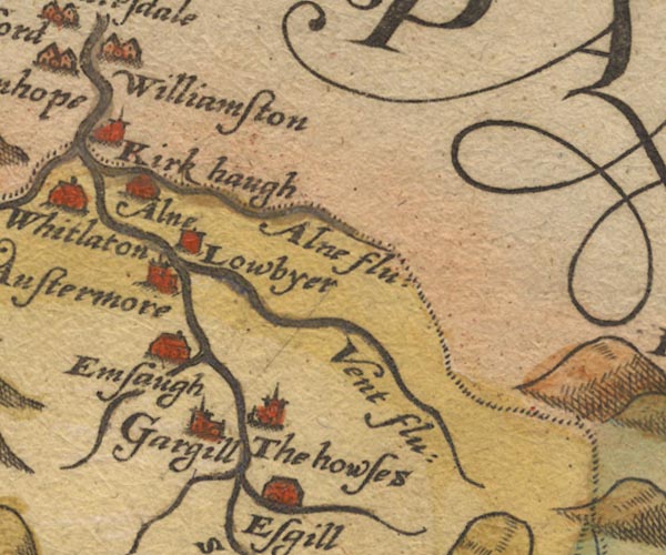 Sax9NY74.jpg item:- private collection : 2 Image © see bottom of page |
|||
|
|
||||
| evidence:- | old map:- Mercator 1595 (edn?) placename:- Blakborn flu. |
|||
| source data:- | Map, hand coloured engraving, Northumbria, Cumberlandia, et
Dunelmensis Episcopatus, ie Northumberland, Cumberland and
Durham etc, scale about 6.5 miles to 1 inch, by Gerard Mercator,
Duisberg, Germany, about 1595. MER8CumD.jpg "Blakborn flu." double line with stream lines; river, running into the South Tyne item:- JandMN : 169 Image © see bottom of page |
|||
|
|
||||
| evidence:- | old map:- Speed 1611 (Cmd) |
|||
| source data:- | Map, hand coloured engraving, Cumberland and the Ancient Citie
Carlile Described, scale about 4 miles to 1 inch, by John Speed,
1610, published by J Sudbury and George Humble, Popes Head
Alley, London, 1611-12.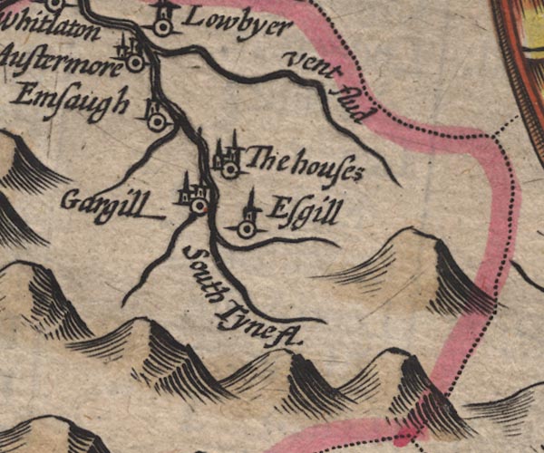 SP11NY74.jpg wiggly line, runs into the South tyne item:- private collection : 16 Image © see bottom of page |
|||
|
|
||||
| evidence:- | old map:- Jansson 1646 |
|||
| source data:- | Map, hand coloured engraving, Cumbria and Westmoria, ie
Cumberland and Westmorland, scale about 3.5 miles to 1 inch, by
John Jansson, Amsterdam, Netherlands, 1646.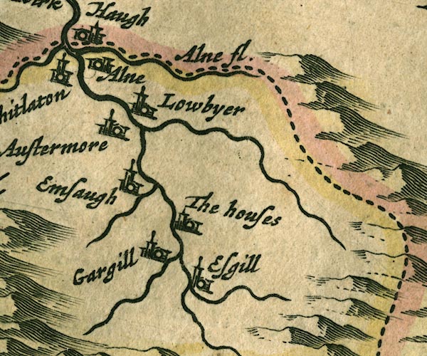 JAN3NY74.jpg Single wiggly line. item:- JandMN : 88 Image © see bottom of page |
|||
|
|
||||
| evidence:- | old map:- Morden 1695 (Cmd) |
|||
| source data:- | Map, uncoloured engraving, Cumberland, scale about 4 miles to 1
inch, by Robert Morden, 1695, published by Abel Swale, the
Unicorn, St Paul's Churchyard, Awnsham, and John Churchill, the
Black Swan, Paternoster Row, London, 1695-1715.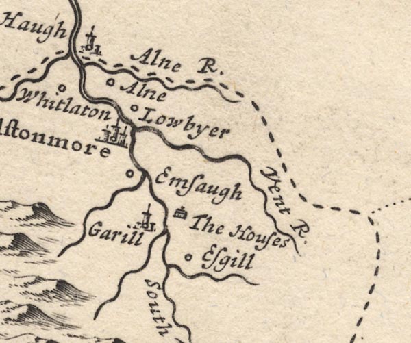 MD12NY74.jpg Running into the South Tyne near Emsaugh. item:- JandMN : 90 Image © see bottom of page |
|||
|
|
||||
| evidence:- | old text:- Gents Mag placename:- Blackaburn |
|||
| source data:- | Magazine, The Gentleman's Magazine or Monthly Intelligencer or
Historical Chronicle, published by Edward Cave under the
pseudonym Sylvanus Urban, and by other publishers, London,
monthly from 1731 to 1922. goto source Gentleman's Magazine 1747 p.385 "... We pass'd the river Tine near its confluence with Blackaburn, beyond which this immense waste begins, ..." "At the bottom of this height [Roderic Heights] Blackaburn is divided into two branches, the eastermost tumbling over a precipice of 40 perpendicular yards, which makes a most wild, surprizing cascade." "From this rivulet we are to account the rise of Cross-fell. ..." |
|||
|
|
||||
| evidence:- | old map:- Donald 1774 (Cmd) placename:- Black Burn |
|||
| source data:- | Map, hand coloured engraving, 3x2 sheets, The County of Cumberland, scale about 1
inch to 1 mile, by Thomas Donald, engraved and published by Joseph Hodskinson, 29
Arundel Street, Strand, London, 1774. D4NY74SW.jpg "Black Burn"  D4NY74SE.jpg "Black Burn" single or double wiggly line; a river, running into the South Tyne item:- Carlisle Library : Map 2 Images © Carlisle Library |
|||
|
|
||||
| places:- |
|
|||
Lakes Guides menu.