 Old Cumbria Gazetteer
 |
 |
|
| Birkhouse Moor, Patterdale | ||
| Birkhouse Moor | ||
| civil parish:- | Patterdale (formerly Westmorland) | |
| county:- | Cumbria | |
| locality type:- | moor | |
| coordinates:- | NY36471644 (etc) | |
| 1Km square:- | NY3616 | |
| 10Km square:- | NY31 | |
|
|
||
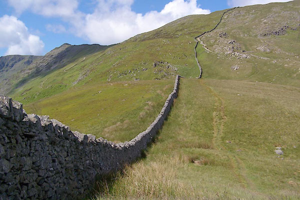 BUU90.jpg (taken 20.6.2011) |
||
|
|
||
| evidence:- | old map:- OS County Series (Wmd 12 10) placename:- Birkhouse Moor |
|
| source data:- | Maps, County Series maps of Great Britain, scales 6 and 25
inches to 1 mile, published by the Ordnance Survey, Southampton,
Hampshire, from about 1863 to 1948. |
|
|
|
||
| evidence:- | old map:- Donald 1774 (Cmd) placename:- Stang Fell |
|
| source data:- | Map, hand coloured engraving, 3x2 sheets, The County of Cumberland, scale about 1
inch to 1 mile, by Thomas Donald, engraved and published by Joseph Hodskinson, 29
Arundel Street, Strand, London, 1774.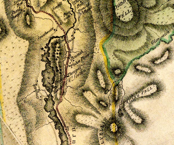 D4NY31NW.jpg "STANG FELL" hill hachuring; a hill or mountain item:- Carlisle Library : Map 2 Image © Carlisle Library |
|
|
|
||
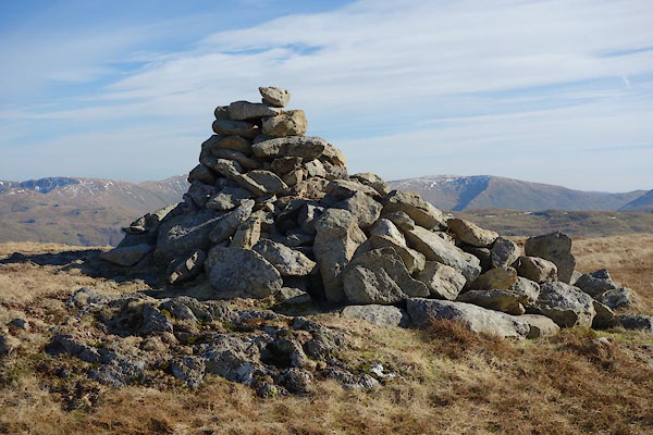 CET52.jpg Cairn, (taken 14.3.2016)  CET54.jpg Lenticular cloud, over Dollywagon Pike. (taken 14.3.2016) |
||
|
|
||
 Lakes Guides menu.