 Old Cumbria Gazetteer
 |
 |
|
| Beacon Hill, Orton S | ||
| Beacon Hill | ||
| Orton Beacon | ||
| locality:- | Great Asby Scar | |
| civil parish:- | Orton S (formerly Westmorland) | |
| civil parish:- | Crosby Ravensworth (formerly Westmorland) | |
| county:- | Cumbria | |
| locality type:- | hill | |
| locality type:- | beacon | |
| coordinates:- | NY63460996 (?) | |
| 1Km square:- | NY6309 | |
| 10Km square:- | NY60 | |
| altitude:- | 1283 feet | |
| altitude:- | 391m | |
|
|
||
| evidence:- | old map:- Saxton 1579 |
|
| source data:- | Map, hand coloured engraving, Westmorlandiae et Cumberlandiae Comitatus ie Westmorland
and Cumberland, scale about 5 miles to 1 inch, by Christopher Saxton, London, engraved
by Augustinus Ryther, 1576, published 1579-1645.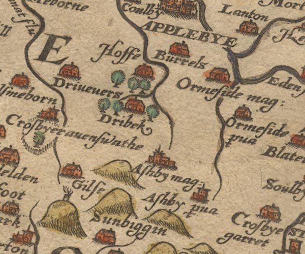 Sax9NY61.jpg NW of Sunbiggin; small tower with flames. item:- private collection : 2 Image © see bottom of page |
|
|
|
||
| evidence:- | old map:- Jansson 1646 |
|
| source data:- | Map, hand coloured engraving, Cumbria and Westmoria, ie
Cumberland and Westmorland, scale about 3.5 miles to 1 inch, by
John Jansson, Amsterdam, Netherlands, 1646.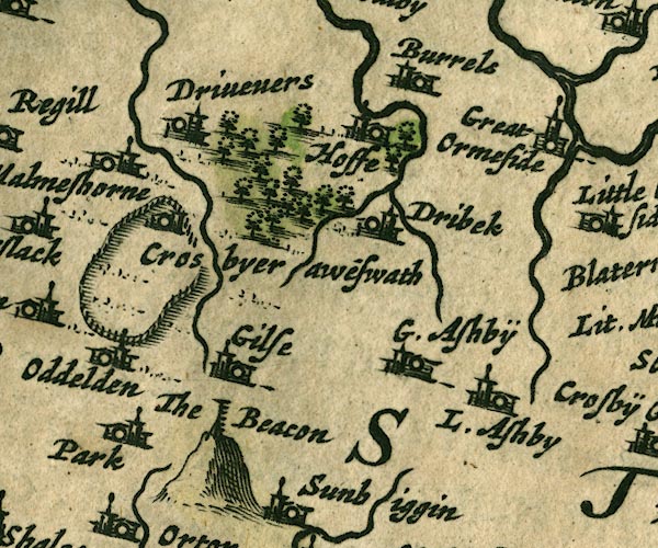 JAN3NY61.jpg "The Beacon" Hillock, post with ladder rungs etc. item:- JandMN : 88 Image © see bottom of page |
|
|
|
||
| evidence:- | old map:- Morden 1695 (Wmd) |
|
| source data:- | Map, hand coloured engraving, Westmorland, scale about 2.5 miles to 1 inch, by Robert
Morden, published by Abel Swale, the Unicorn, St Paul's Churchyard, Awnsham, and John
Churchill, the Black Swan, Paternoster Row, London, 1695.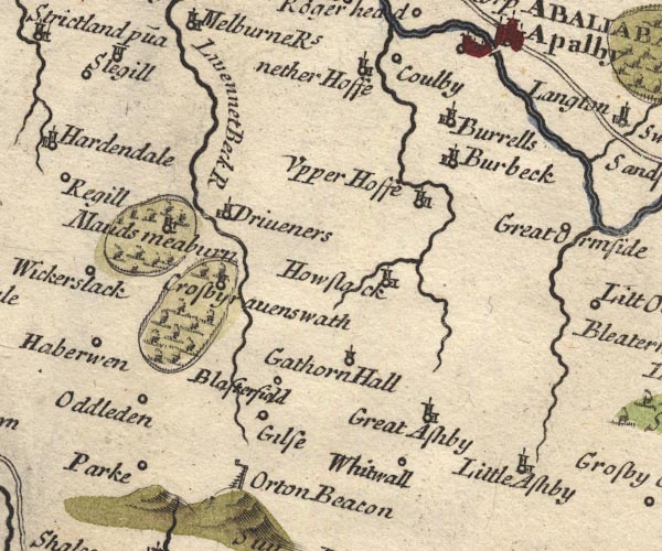 MD10NY61.jpg "Orton Beacon" Post with a cresset on a bracket, and a ladder up the side. item:- JandMN : 24 Image © see bottom of page |
|
|
|
||
| evidence:- | old map:- Cary 1789 (edn 1805) placename:- Beacon |
|
| source data:- | Map, uncoloured engraving, Westmoreland, scale about 2.5 miles
to 1 inch, by John Cary, London, 1789; edition 1805.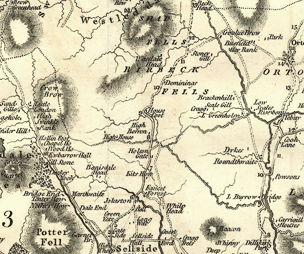 CY24NY50.jpg "Beacon" hill hachuring item:- JandMN : 129 Image © see bottom of page |
|
|
|
||
 Lakes Guides menu.