 Old Cumbria Gazetteer
 |
 |
|
| Barton Fell, Barton | ||
| Barton Fell | ||
| civil parish:- | Barton (formerly Westmorland) | |
| county:- | Cumbria | |
| locality type:- | hill | |
| locality type:- | fell | |
| coordinates:- | NY467211 (etc) | |
| 1Km square:- | NY4621 | |
| 10Km square:- | NY42 | |
|
|
||
| evidence:- | outline view:- Otley 1823 (8th edn 1849) placename:- Barton Fell |
|
| source data:- | Engraving, outline view of mountains, Ullswater from Pooley Bridge, drawn by T Binns,
engraved by O Jewitt, opposite p.12 of A Descriptive Guide of the English Lakes, by
Jonathan Otley, 8th edition, 1849.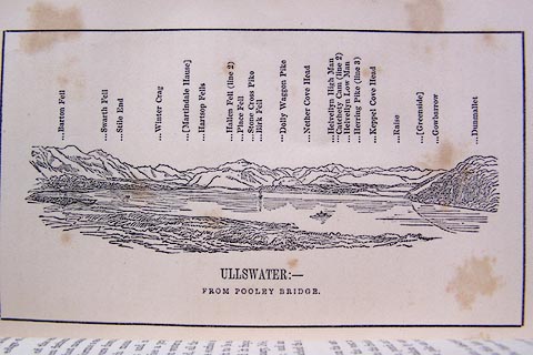 click to enlarge click to enlargeO80E07.jpg item:- Armitt Library : A1180.8 Image © see bottom of page |
|
|
|
||
 Lakes Guides menu.