 Old Cumbria Gazetteer
 |
 |
|
| Barrock Side, Hesket | ||
| Barrock Side | ||
| civil parish:- | Hesket (formerly Cumberland) | |
| county:- | Cumbria | |
| locality type:- | buildings | |
| coordinates:- | NY45474781 | |
| 1Km square:- | NY4547 | |
| 10Km square:- | NY44 | |
|
|
||
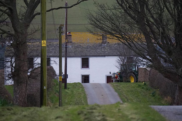 CCR41.jpg (taken 20.3.2015) |
||
|
|
||
| evidence:- | old map:- OS County Series (Cmd 31 6) placename:- Barrockside |
|
| source data:- | Maps, County Series maps of Great Britain, scales 6 and 25
inches to 1 mile, published by the Ordnance Survey, Southampton,
Hampshire, from about 1863 to 1948. |
|
|
|
||
| evidence:- | old map:- Donald 1774 (Cmd) placename:- Barwick Side |
|
| source data:- | Map, hand coloured engraving, 3x2 sheets, The County of Cumberland, scale about 1
inch to 1 mile, by Thomas Donald, engraved and published by Joseph Hodskinson, 29
Arundel Street, Strand, London, 1774.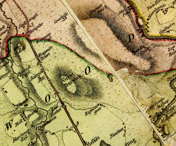 D4NY44NE.jpg "Barwick Side" block or blocks, labelled in lowercase; a hamlet or just a house item:- Carlisle Library : Map 2 Image © Carlisle Library |
|
|
|
||
| evidence:- | database:- Listed Buildings 2010 placename:- Barrockside item:- date stone (1694) |
|
| source data:- | courtesy of English Heritage "BARROCKSIDE / / / HESKET / EDEN / CUMBRIA / II / 73896 / NY4547347810" |
|
|
|
||
 Lakes Guides menu.