 Old Cumbria Gazetteer
 |
 |
|
| Bannisdale, Fawcett Forest | ||
| Bannisdale | ||
| civil parish:- | Fawcett Forest (formerly Westmorland) | |
| civil parish:- | Whitwell and Selside (formerly Westmorland) | |
| county:- | Cumbria | |
| locality type:- | valley | |
| coordinates:- | NY51970321 (etc) | |
| 1Km square:- | NY5103 | |
| 10Km square:- | NY50 | |
| 10Km square:- | NY51 | |
|
|
||
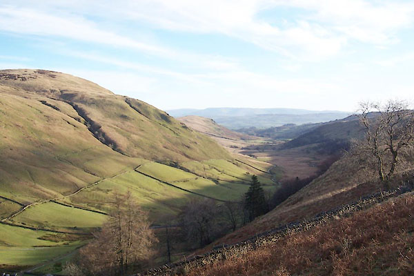 BXS76.jpg (taken 29.11.2012) 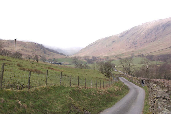 BNK03.jpg (taken 19.3.2007) |
||
|
|
||
| evidence:- | old map:- Ogilby 1675 (plate 38) placename:- Banesdale Horse |
|
| source data:- | Road strip map, hand coloured engraving, continuation of the
Road from London to Carlisle, scale about 1 inch to 1 mile, by
John Ogilby, London, 1675.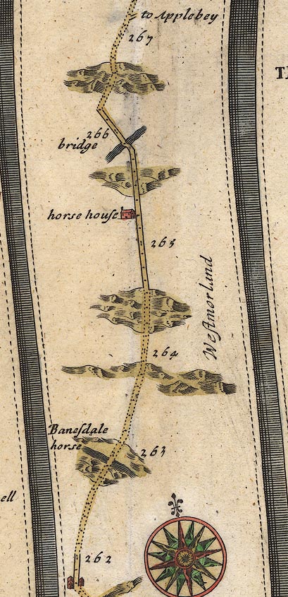 OG38m262.jpg In mile 263, Westmorland. Road ascend a hill to:- "Banesdale horse" item:- JandMN : 21 Image © see bottom of page |
|
|
|
||
| evidence:- | old map:- Morden 1695 (Wmd) placename:- Bawsdale Horse |
|
| source data:- | Map, hand coloured engraving, Westmorland, scale about 2.5 miles to 1 inch, by Robert
Morden, published by Abel Swale, the Unicorn, St Paul's Churchyard, Awnsham, and John
Churchill, the Black Swan, Paternoster Row, London, 1695.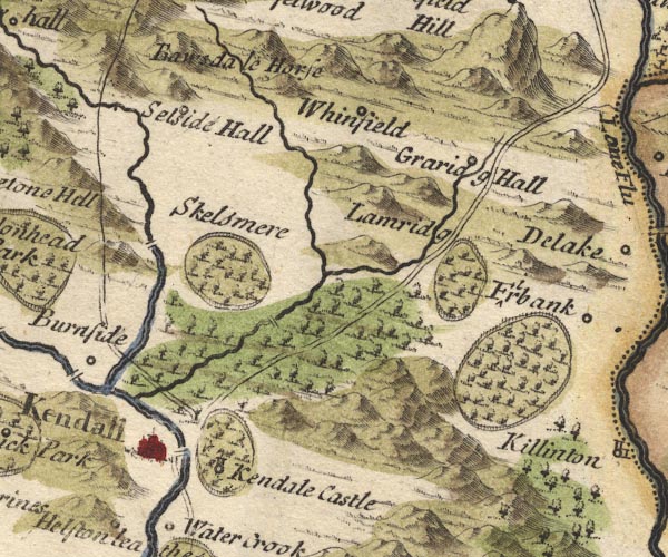 MD10SD59.jpg "Ba[w]sdale Horse" No symbol, perhaps a valley or pass. item:- JandMN : 24 Image © see bottom of page |
|
|
|
||
| evidence:- | old map:- Bowen 1720 (plate 94) placename:- Bannisdale Horse |
|
| source data:- | Strip maps, uncoloured engravings, road maps, The Road from
London to Carlisle, scale about 2 miles to 1 inch, with sections
in Lancashire and Westmorland, published by Emanuel Bowen, St
Katherines, London, 1720.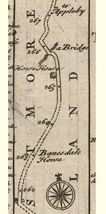 B094m262.jpg At mile 263. item:- Dove Cottage : 2007.38.100 Image © see bottom of page |
|
|
|
||
| hearsay:- |
This is the Marrisdale of Mrs Humphrey Ward's story 'Robert Elsemere'. |
|
| Ward, Humphrey, Mrs:: Robert Elsmere |
||
|
|
||
 Lakes Guides menu.