 Old Cumbria Gazetteer
 |
 |
|
| Bannisdale Head, Fawcett Forest | ||
| Bannisdale Head | ||
| locality:- | Bannisdale | |
| civil parish:- | Fawcett Forest (formerly Westmorland) | |
| county:- | Cumbria | |
| locality type:- | buildings | |
| coordinates:- | NY51510428 | |
| 1Km square:- | NY5104 | |
| 10Km square:- | NY50 | |
|
|
||
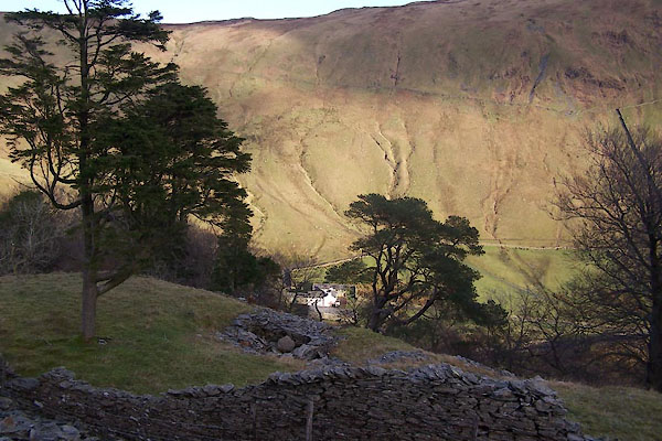 BXS74.jpg (taken 29.11.2012) 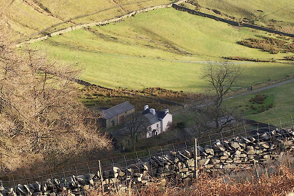 BXS75.jpg (taken 29.11.2012) |
||
|
|
||
| evidence:- | old map:- OS County Series (Wmd 27 12) placename:- Bannisdale Head |
|
| source data:- | Maps, County Series maps of Great Britain, scales 6 and 25
inches to 1 mile, published by the Ordnance Survey, Southampton,
Hampshire, from about 1863 to 1948. |
|
|
|
||
| evidence:- | old map:- Jefferys 1770 (Wmd) placename:- Banisdale Head |
|
| source data:- | Map, 4 sheets, The County of Westmoreland, scale 1 inch to 1
mile, surveyed 1768, and engraved and published by Thomas
Jefferys, London, 1770.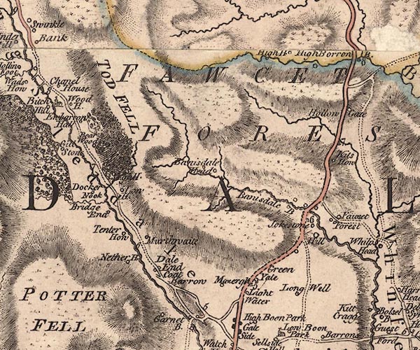 J5NY50SW.jpg "Banisdale Head" circle, labelled in italic lowercase text; settlement, farm, house, or hamlet? item:- National Library of Scotland : EME.s.47 Image © National Library of Scotland |
|
|
|
||
| evidence:- | old map:- Cary 1789 (edn 1805) placename:- Bannisdale Head |
|
| source data:- | Map, uncoloured engraving, Westmoreland, scale about 2.5 miles
to 1 inch, by John Cary, London, 1789; edition 1805.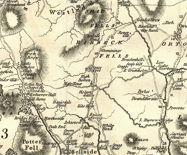 CY24NY50.jpg "Bannisdale Head" block/s, labelled in italic lowercase; house, or hamlet item:- JandMN : 129 Image © see bottom of page |
|
|
|
||
| evidence:- | database:- Listed Buildings 2010 placename:- Bannisdale Head |
|
| source data:- | courtesy of English Heritage "BANNISDALE HEAD / / / FAWCETT FOREST / SOUTH LAKELAND / CUMBRIA / II / 75628 / NY5149404240" |
|
|
|
||
| evidence:- | database:- Listed Buildings 2010 |
|
| source data:- | courtesy of English Heritage "BARN TO NORTH END OF BANNISDALE HEAD / / / FAWCETT FOREST / SOUTH LAKELAND / CUMBRIA / II / 75629 / NY5150304268" |
|
|
|
||
| hearsay:- |
Mid to late 17th century, with 19th century wing to the south. There should be a fireplace
with a wood heck. |
|
|
|
||
 Lakes Guides menu.