 Old Cumbria Gazetteer
 |
 |
|
| Baggrow Station, Baggrow | ||
| Baggrow Station | ||
| site name:- | Maryport and Carlisle Railway | |
| locality:- | Baggrow | |
| civil parish:- | Allhallows (formerly Cumberland) | |
| county:- | Cumbria | |
| locality type:- | railway station | |
| coordinates:- | NY17974195 | |
| 1Km square:- | NY1741 | |
| 10Km square:- | NY14 | |
| SummaryText:- | Opened 1866; closed 1930. | |
|
|
||
| evidence:- | old map:- OS County Series (Cmd 36 6) item:- weighing machine |
|
| source data:- | Maps, County Series maps of Great Britain, scales 6 and 25
inches to 1 mile, published by the Ordnance Survey, Southampton,
Hampshire, from about 1863 to 1948.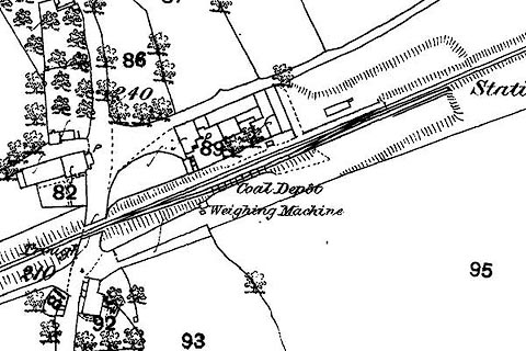 click to enlarge click to enlargeCSRY0050.jpg "Station / Coal Depot / Weighing Machine" at Baggrow |
|
|
|
||
 Lakes Guides menu.