 Old Cumbria Gazetteer
 |
 |
|
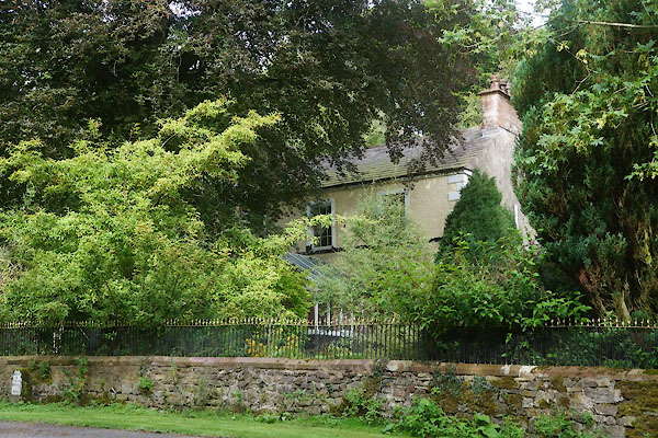
| Augill House, Augill | ||
| Augill House | ||
| locality:- | Augill | |
| civil parish:- | Brough (formerly Westmorland) | |
| county:- | Cumbria | |
| locality type:- | buildings | |
| coordinates:- | NY81421474 | |
| 1Km square:- | NY8114 | |
| 10Km square:- | NY81 | |
|
|
||
 CFM98.jpg (taken 23.9.2016) |
||
|
|
||
| evidence:- | old map:- OS County Series (Wmd 16 16) placename:- Augill House |
|
| source data:- | Maps, County Series maps of Great Britain, scales 6 and 25
inches to 1 mile, published by the Ordnance Survey, Southampton,
Hampshire, from about 1863 to 1948. |
|
|
|
||
| evidence:- | database:- Listed Buildings 2010 placename:- Augill House |
|
| source data:- | courtesy of English Heritage "AUGILL HOUSE &FORMER COACH-HOUSE / / A66 (EAST OF BROUGH) / BROUGH / EDEN / CUMBRIA / II / 73289 / NY8143714742" |
|
|
|
||
| evidence:- | database:- Listed Buildings 2010 |
|
| source data:- | courtesy of English Heritage "FORECOURT WALL, RAILINGS AND GATE TO FRONT OF AUGILL HOUSE / / A66 (EAST OF BROUGH) / BROUGH / EDEN / CUMBRIA / II / 73290 / NY8142914722" |
|
|
|
||
 Lakes Guides menu.