 Old Cumbria Gazetteer
 |
 |
|
| railway sidings, Aspatria | ||
| Aspatria Junction | ||
| site name:- | Maryport and Carlisle Railway | |
| locality:- | Aspatria Pit No.1 | |
| locality:- | Aspatria Pit No.2 | |
| locality:- | Aspatria | |
| civil parish:- | Aspatria (formerly Cumberland) | |
| county:- | Cumbria | |
| locality type:- | railway sidings | |
| locality type:- | railway junction | |
| coordinates:- | NY14504135 | |
| coordinates:- | NY14734111 | |
| 1Km square:- | NY1441 | |
| 10Km square:- | NY14 | |
|
|
||
| evidence:- | old map:- OS County Series (Cmd 36 9) |
|
| source data:- | Maps, County Series maps of Great Britain, scales 6 and 25
inches to 1 mile, published by the Ordnance Survey, Southampton,
Hampshire, from about 1863 to 1948.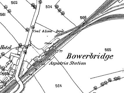 click to enlarge click to enlargeCSRY0054.jpg Bolton branch, and to Aspatria Colliery |
|
|
|
||
 Lakes Guides menu.