 Old Cumbria Gazetteer
 |
 |
|
| Ashness Farm, Borrowdale | ||
| Ashness Farm | ||
| locality:- | Ashness | |
| civil parish:- | Borrowdale (formerly Cumberland) | |
| county:- | Cumbria | |
| locality type:- | buildings | |
| coordinates:- | NY27171928 | |
| 1Km square:- | NY2719 | |
| 10Km square:- | NY21 | |
|
|
||
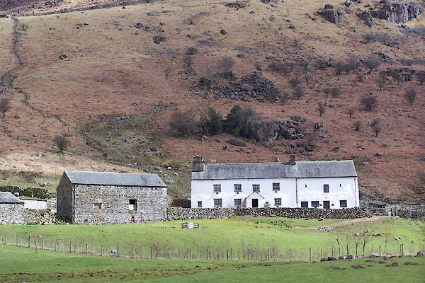 BLT91.jpg (taken 3.4.2006) |
||
|
|
||
| evidence:- | old map:- OS County Series (Cmd 64 14) placename:- Ashness |
|
| source data:- | Maps, County Series maps of Great Britain, scales 6 and 25
inches to 1 mile, published by the Ordnance Survey, Southampton,
Hampshire, from about 1863 to 1948. |
|
|
|
||
| evidence:- | old map:- Crosthwaite 1783-94 (Der) |
|
| source data:- | Map, uncoloured engraving, An Accurate Map of the Matchless Lake
of Derwent, ie Derwent Water, scale about 3 inches to 1 mile, by
Peter Crosthwaite, Keswick, Cumberland, 1783, version published
1800.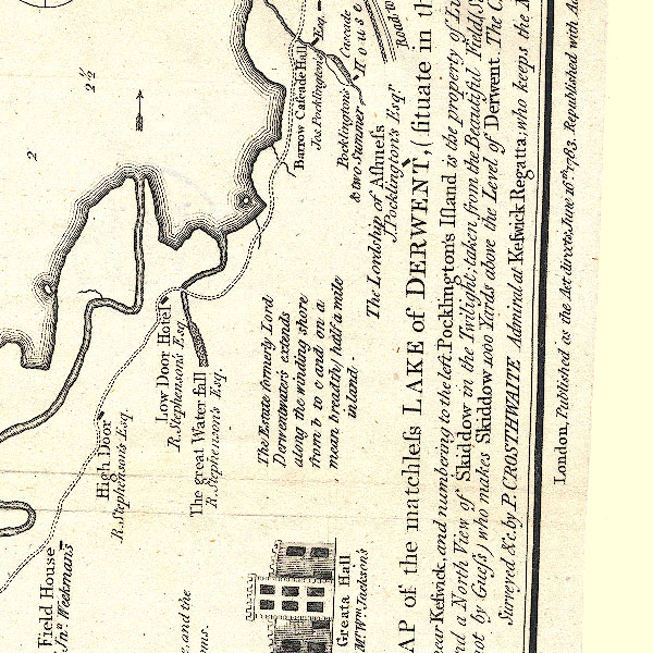 CT2NY21T.jpg "The Lordship of Ashness / J. Pocklington's Esqr." item:- Armitt Library : 1959.191.3 Image © see bottom of page |
|
|
|
||
| evidence:- | database:- Listed Buildings 2010 placename:- Ashness Farm |
|
| source data:- | courtesy of English Heritage "ASHNESS FARMHOUSE AND ADJOINING BARN / / / BORROWDALE / ALLERDALE / CUMBRIA / II / 72125 / NY2717219317" |
|
|
|
||
 Lakes Guides menu.