 Old Cumbria Gazetteer
 |
 |
|
| Angler's Crag, Ennerdale and Kinniside | ||
| Angler's Crag | ||
| civil parish:- | Ennerdale and Kinniside (formerly Cumberland) | |
| county:- | Cumbria | |
| locality type:- | rocks | |
| coordinates:- | NY09881504 (etc) | |
| 1Km square:- | NY0915 | |
| 10Km square:- | NY01 | |
|
|
||
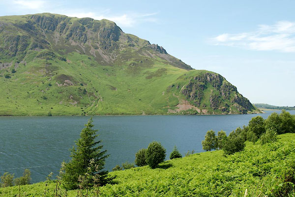 BQW45.jpg and Revelin Crag. (taken 25.6.2009) 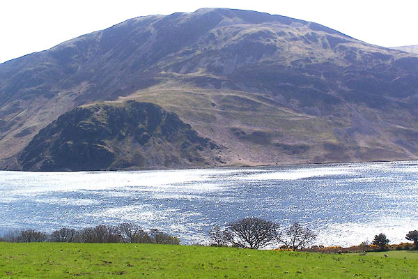 BMA12.jpg and Crag Fell. (taken 3.5.2006) |
||
|
|
||
| evidence:- | old map:- OS County Series (Cmd 68 11) placename:- Angler's Crag |
|
| source data:- | Maps, County Series maps of Great Britain, scales 6 and 25
inches to 1 mile, published by the Ordnance Survey, Southampton,
Hampshire, from about 1863 to 1948. |
|
|
|
||
| evidence:- | old text:- Green 1810 placename:- Anglingstone |
|
| source data:- | Set of prints, soft ground etchings, Sixty Studies from Nature,
by William Green, Ambleside, Westmorland, drawn 1808-10,
published 1810. goto source goto sourcepage 72:- "[Ennerdale Water] ... the western boundary, which, excepting at Anglingstone, is something smooth and uniform in its height all the way up the side of the lake ,..." |
|
|
|
||
| evidence:- | old print:- Wilkinson 1810 (plate 40) |
|
| source data:- | Print, uncoloured soft ground etching, Ennerdale Broad Water, Cumberland, by Joseph
Wilkinson, engraved by William Frederick Wells, published by R Ackermann, Repository
of Arts, 101 Strand, London, 1810.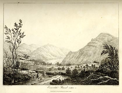 click to enlarge click to enlargeWKN140.jpg Plate 40 in Select Views in Cumberland, Westmoreland, and Lancashire. printed at bottom left, right, centre:- "The Revd. Jos: Wilkinson delt. / W. F. Wells Sculpt. / Ennerdale Broad-water / Publish'd Jany. 1. 1810. by R. Ackerman. 101. Strand. London." item:- Fell and Rock Climbing Club : MN4.40 Image © see bottom of page |
|
|
|
||
| evidence:- | old text:- Green 1814 placename:- Angling Stone |
|
| source data:- | Set of prints, soft ground etchings, Sixty Small Prints, with
text, A Description of a Series of Sixty Small Prints, by
William Green, Ambleside, Westmorland, 1814. goto source page 23:- "... the western boundary [of Ennerdale Water], which, excepting at Angling Stone, is rather smooth and uniform in its height all the way to the head of the lake. ..." |
|
|
|
||
| evidence:- | old print:- Fielding and Walton 1821 (plate 31) |
|
| source data:- | Print, coloured aquatint, Ennerdale Water, Ennerdale and Kinniside, Cumberland, drawn
by Theodore H A Fielding, published by R Ackermann, 101 Strand, London, 1821.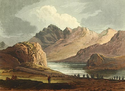 click to enlarge click to enlargeFW0131.jpg Bowness Knott and Angler's Crag are prominent. Tipped in opposite p.206 in A Picturesque Tour of the English Lakes. item:- Dove Cottage : 1993.R566.31 Image © see bottom of page |
|
|
|
||
| evidence:- | presumably outline view:- Otley 1823 (8th edn 1849) placename:- Anglebarrow |
|
| source data:- | Engraving, outline view of mountains, Ennerdale from a Field near Kirkland and Salter,
drawn by T Binns, engraved by O Jewitt, opposite p.20 of A Descriptive Guide of the
English Lakes, by Jonathan Otley, 8th edition, 1849.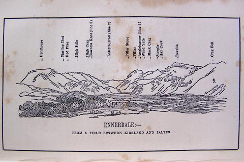 click to enlarge click to enlargeO80E11.jpg item:- Armitt Library : A1180.12 Image © see bottom of page |
|
|
|
||
| evidence:- | old print:- Pyne 1853 |
|
| source data:- | Print, tinted lithograph, Ennerdale Lake, Cumberland, by James Baker Pyne, engraved
by W Gauci, published by Thomas Agnew and Sons, Manchester, Lancashire, 1853.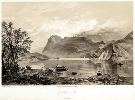 click to enlarge click to enlargePYN205.jpg "PAINTED BY J. B. PYNE. / W. GAUCI LITH. / MANCHESTER, PUBLISHED BY THOMAS AGNEW & SONS, 1853. / Ennerdale Lake / M & N HANHART IMPT." item:- Armitt Library : A6678.6 Image © see bottom of page |
|
|
|
||
| evidence:- | old print:- Pyne 1853 |
|
| source data:- | Print, coloured lithograph, Ennerdale Lake, Cumberland, by James Baker Pyne, engraved
by W Gauci, published by Thomas Agnew and Sons, Manchester, Lancashire, 1853.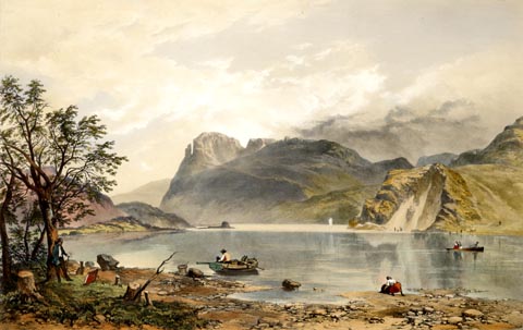 click to enlarge click to enlargePYN405.jpg item:- Armitt Library : A6677.6 Image © see bottom of page |
|
|
|
||
| evidence:- | perhaps old painting:- |
|
| source data:- | Painting, watercolour, Mountain and Lake Scene, Cumbria, by Frederick Clive Newcome,
1889.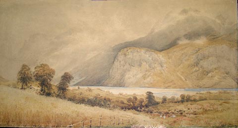 click to enlarge click to enlargePR0925.jpg Autumn; to left of composition lies a sloping cornfield flanked by a hedge beyond which the roof of a small building is visible in the midst a stand of tall trees. A narrow path winds downhill beside the cornfield towards the lake side; three geese stand amidst clumps of heather beside the path to right of composition. Intervening landscape of woods and fields fills centre of composition. Barren fells rise above the lake, some of them cloaked in mist. Perhaps Angler's Crag on Ennerdale Water. signed &dated at bottom left:- "NEWCOME 89" item:- Tullie House Museum : 1936.4.4 Image © Tullie House Museum |
|
|
|
||
| evidence:- | old print:- Prior 1865 |
|
| source data:- | Print, uncoloured engraving, Ennerdale, with Revelin Crag and Angler's Crag, Ennerdale
and Kinniside, Cumberland, published by John Garnett, Windermere, Westmorland, and
by Simpkin, Marshall and Co, London, 1865.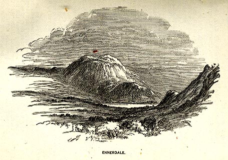 click to enlarge click to enlargePI0104.jpg Included on page 10 of the guide book, Ascents and Passes in the Lake District of England, by Herman Prior. printed at bottom:- "ENNERDALE." item:- JandMN : 235.6 Image © see bottom of page |
|
|
|
||
| evidence:- | old print:- Pyne 1853 |
|
| source data:- | Drawn by James Barker Pyne, 1848-1853, lithographed by T Picken, 1859.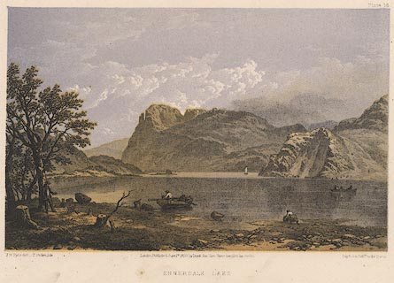 click to enlarge click to enlargePY16.jpg "Ennerdale Lake" item:- JandMN : 97.15 Image © see bottom of page |
|
|
|
||
 BWO12.jpg (taken 16.5.2012)  BWO13.jpg (taken 16.5.2012) |
||
|
|
||
Lakes Guides menu.