 Old Cumbria Gazetteer
 |
 |
|
| Frith Hall, Lower Allithwaite | ||
| Frith Hall | ||
| civil parish:- | Lower Allithwaite (formerly Lancashire) | |
| county:- | Cumbria | |
| locality type:- | building/s (ruins) | |
| coordinates:- | SD33827976 | |
| 1Km square:- | SD3379 | |
| 10Km square:- | SD37 | |
|
|
||
| evidence:- | old map:- Ford 1839 map placename:- Frith Hall |
|
| source data:- | Map, uncoloured engraving, Map of the Lake District of
Cumberland, Westmoreland and Lancashire, scale about 3.5 miles
to 1 inch, published by Charles Thurnam, Carlisle, and by R
Groombridge, 5 Paternoster Row, London, 3rd edn 1843.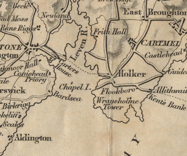 FD02SD37.jpg "Frith Hall" item:- JandMN : 100.1 Image © see bottom of page |
|
|
|
||
| notes:- |
site of a hall |
|
| Perriam, D R &Robinson, J: 1998: Medieval Fortified Buildings of Cumbria: CWAAS::
ISBN 1 873124 23 6 |
||
|
|
||
 Lakes Guides menu.