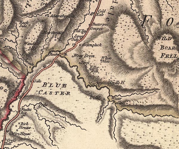
 Jefferys 1770 SD79NW

|

|
|
|
gazetteer links places may or may not be labelled on the map |
||

|
-- Adamthwaite -- "Adamthwaite" |
|
|
|
-- Ash Pot -- "Hill Top" |
|
|
|
-- Bluecaster Side -- "Side" |
|
|
|
-- Bluecaster -- "BLUE CASTER" |
|
|
|
-- Butterpot -- "Butterpot" |
|
|
|
-- Eller Hill -- "Eller Hill" |
|
|
|
-- Elm Pot -- "Ompot" |
|
|
|
-- Green Slack -- "Greenslack" |
|
|
|
-- Murthwaite -- "Murthwaite" |
|
|
|
-- Narthwaite -- "Nathwaite" |
|
|
|
-- Needle House -- "Needle H" |
|
|
|
-- Needlehouse Gill |
|
|
|
-- New House -- "New H" |
|
|
|
-- Rawthey Bridge -- "Roatha B." |
|
|
|
-- Sedbergh to Kirkby Stephen |
|
|
|
-- Sally Beck |
|
|
|
-- Slate Gill |
|
|
|
-- Streetside -- "Street Side" |
|
|
|
-- Tarn -- "Tarn" |
|
|
|
-- Taythes Gill |
|
|
|
-- Taythes -- "Tyths" |
|
|
|
-- Uldale House -- "Uldale" |
|
|
|
-- Wandale -- "Wandale Side" |
|
|
|
-- waterfall, Uldale -- "Water Falls" |
|
|
|
-- Whin Stone Gill |
|
|
|
-- White Green -- "White Mea" |
|
|
|
-- Wraygreen Farm -- "Wray Green" |
|
|
civil parishes The area roughly includes parts of parishes:- Ravenstonedalen Sedbergh |
||
|
|
||
|
|
Lakes Guides menu. | |