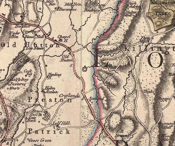
 Jefferys 1770 SD58NE

|

|
|
|
gazetteer links places may or may not be labelled on the map |
||

|
-- Audlands Park -- "Audland" |
|
|
|
-- Barkinbeck Bridge |
|
|
|
-- Blaystone Bridge |
|
|
|
-- Blease Hall -- "Blease Hall" |
|
|
|
-- bridge, Old Hutton |
|
|
|
-- Church View -- "Chapel H." |
|
|
|
-- Cocklet Wood |
|
|
|
-- Crosslands Farm -- "Croslands" |
|
|
|
-- Healing -- "Healing H." |
|
|
|
-- High Bracken Hall -- "Brackon Hall" |
|
|
|
-- Holmescales -- "Holm Scales" |
|
|
|
-- Hood Tarn |
|
|
|
-- Low Audlands -- "Audland" |
|
|
|
-- Low Bleaze -- "Low Blease" |
|
|
|
-- Low Bracken Hall -- "Brackon Hall" |
|
|
|
-- Middleshaw |
|
|
|
-- Old Hutton -- "Old Hutton" |
|
|
|
-- Preston Patrick -- "Preston Patrick" |
|
|
|
-- Kendal to Kirkby Lonsdale-- Kendal to Kirkby Lonsdale |
|
|
|
-- Killington road |
|
|
|
-- Sill Field -- "Self Hill" |
|
|
|
-- St John's Church |
|
|
civil parishes The area roughly includes parts of parishes:- New Hutton Old Hutton and Holmescales Killington Preston Patrick Lupton Mansergh |
||
|
|
||
|
|
Lakes Guides menu. | |