 Jefferys 1770 NY70NW

|

|
|
|
gazetteer links places may or may not be labelled on the map |
||

|
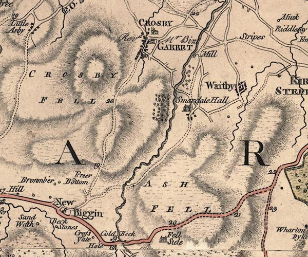
-- Ash Fell -- "ASH FELL" |
|
|
|
-- Beckstones -- "Beck Stones" |
|
|
|
-- Crosby Garrett Fell -- "CROSBY FELL" |
|
|
|
-- Crosby Garrett -- "CROSBY GARRET" |
|
|
|
-- Demesne Wood |
|
|
|
-- Friar's Bottom Farm -- "Freer Bottom" |
|
|
|
-- Newbiggin-on-Lune -- "New Biggin" |
|
|
|
-- Old Rectory, The -- "Revd Mr Bird" |
|
|
|
-- Oxenbrow Wood |
|
|
|
-- Newbiggin-on-Lune to Brough |
|
|
|
-- Tebay to Kirkby Stephen |
|
|
|
-- Smardale Hall (?) -- "Smardale Hall" |
|
|
|
-- Smardale Mill Farm -- "Mill" |
|
|
|
-- Smardale |
|
|
|
-- St Andrew's Church |
|
|
|
-- Stripes -- "Stripes" |
|
|
|
-- Waitby -- "Waitby" |
|
|
civil parishes The area roughly includes parts of parishes:- Asby Crosby Garrett Waitby Soulby Kirkby Stephen Ravenstonedale |
||
|
|
||
|
|
Lakes Guides menu. | |