 Jefferys 1770 NY42NE

|

|
|
|
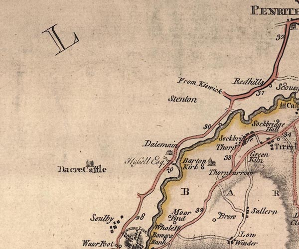
gazetteer links places may or may not be labelled on the map |
||

|
-- Barton -- "Barton" -- "BARTON" |
|
|
|
-- Celleron -- "Sallern" |
|
|
|
-- Dacre Bridge |
|
|
|
-- Dacre Castle -- "Dacre Castle" |
|
|
|
-- Dalemain -- "Dalemain / Hassell Esq." |
|
|
|
-- Eamont, River -- "Emont River" |
|
|
|
-- High Brow -- "Brow" |
|
|
|
-- Kirkbarrow Hall -- "Thornburrow" |
|
|
|
-- Low Brow -- "Brow" |
|
|
|
-- Moorend -- "Moor End" |
|
|
|
-- Patterdale to Penrith -- "F. A. to P. 23'4" |
|
|
|
-- Penrith to Keswick -- "From Keswick" |
|
|
|
-- Snuffmill |
|
|
|
-- Sockbridge -- "Sockbridge" |
|
|
|
-- Soulby -- "Soulby" |
|
|
|
-- St Michael's Church -- "Barton Kirk" |
|
|
|
-- Stainton -- "Stenton" |
|
|
|
-- Thorpe -- "Thorp" |
|
|
civil parishes The area roughly includes parts of parishes:- Penrith Dacre Barton Sockbridge and Tirril |
||
|
|
||
|
|
Lakes Guides menu. | |