 Jefferys 1770 NY40SE

|

|
|
|
gazetteer links places may or may not be labelled on the map |
||

|
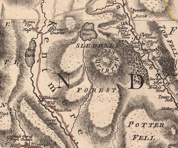
-- barn, Longsleddale -- "Chapel House" |
|
|
|
-- Beech Hill Wood |
|
|
|
-- Beech Hill -- "Bitch Hill" |
|
|
|
-- Bell Green -- "Well Green" |
|
|
|
-- Black Beck |
|
|
|
-- Brow Top Farm -- "Brow Top" |
|
|
|
-- Dockernook Wood |
|
|
|
-- Goose Howe -- "Goose How" |
|
|
|
-- Green Quarter Fell -- "GREEN QUARTER" |
|
|
|
-- Green Quarter -- "Green Quarter" |
|
|
|
-- Hollin Root -- "Hollin Foot" |
|
|
|
-- Kent, River -- "Kent R." -- "Kent R." --
"KENT RIVER" |
|
|
|
-- Kentmere Tarn -- "The Tarn" |
|
|
|
-- Kentmere -- "Kentmere" |
|
|
|
-- Kilnstones Wood |
|
|
|
-- Kilnstones -- "Gill Stone" |
|
|
|
-- Longsleddale -- "Long Sleddale" |
|
|
|
-- Low Bridge |
|
|
|
-- Garnett Bridge to Sadgill |
|
|
|
-- Staveley to Kentmere |
|
|
|
-- Skeggles Water -- "Skeggles Water" |
|
|
|
-- Skeggleswater Dike |
|
|
|
-- Sleddale Forest -- "SLEDDALE FOREST" |
|
|
|
-- St Cuthbert's Church |
|
|
|
-- St Mary's Church |
|
|
|
-- Ullthwaite Bridge |
|
|
|
-- Ullthwaite Mill |
|
|
|
-- Ullthwaite -- "Ulthwaite" |
|
|
|
-- Underhill House -- "Under Hill" |
|
|
|
-- Wads Howe -- "Wads How" |
|
|
|
-- Wadshowe Bridge |
|
|
|
-- White Howe -- "White How" |
|
|
civil parishes The area roughly includes parts of parishes:- Kentmere Longsleddale Hugill Over Staveley Strickland Roger |
||
|
|
||
|
|
Lakes Guides menu. | |