 Jefferys 1770 SD5192Z

|

|
|
|
gazetteer links places may or may not be labelled on the map |
||

|
-- Goose Holme |
|
|
|
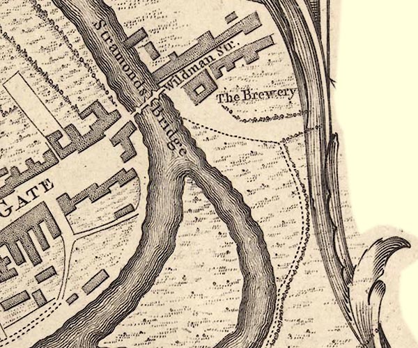
-- Wildman Street -- "Wildman Str." |
|
|
|
-- Kent, River -- "KENT RIVER"-- Kent, River --
"Kent R." -- "Kent R." -- "KENT
RIVER" |
|
|
|
-- Old Brewery, The -- "The Brewery" |
|
|
|
-- Kendal to Sedbergh-- Kendal to Sedbergh |
|
|
|
-- Kendal to Shap-- Kendal to Shap |
|
|
|
-- Stramongate Bridge -- "Stramonds Bridge"--
Stramongate Bridge |
|
|
civil parishes The area roughly includes parts of parishes:- Kendal |
||
|
|
||
|
|
Lakes Guides menu. | |