 Jefferys 1770 SD5192N

|

|
|
|
gazetteer links places may or may not be labelled on the map |
||

|
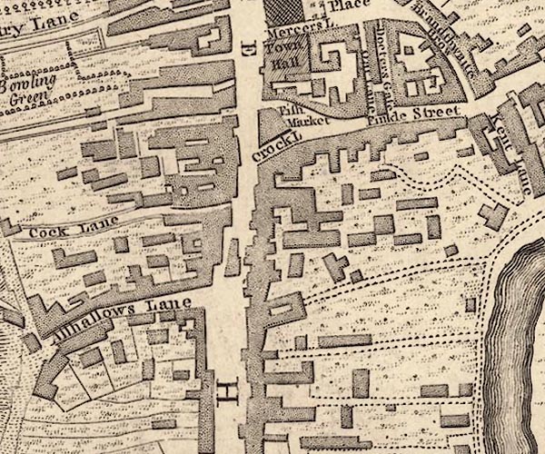
-- Allhallows Lane -- "Allhallows Lane" |
|
|
|
-- Crock Lane -- "Crock L" |
|
|
|
-- Finkle Street -- "Finkle Street" |
|
|
|
-- Fish Market -- "Fish Market" |
|
|
|
-- Highgate -- "HIGH GATE" |
|
|
|
-- New Shambles -- "Oat Lane" |
|
|
|
-- Stramongate -- "STRAMONDS GATE" |
|
|
civil parishes The area roughly includes parts of parishes:- Kendal |
||
|
|
||
|
|
Lakes Guides menu. | |