 Jefferys 1770 SD5191U

|

|
|
|
gazetteer links places may or may not be labelled on the map |
||

|
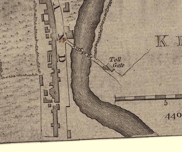
-- Kirkland -- "KIRKLAND" |
|
|
|
-- Kent, River -- "KENT RIVER"-- Kent, River --
"Kent R." -- "Kent R." -- "KENT
RIVER" |
|
|
|
-- Nether Bridge Turn Pike -- "Toll Gate"-- Nether
Bridge Turn Pike -- "Toll Gate" |
|
|
|
-- Nether Bridge -- "Nether Br"-- Nether Bridge --
"Nether Bridge" |
|
|
|
-- Lancaster to Kendal-- Lancaster to Kendal -- "from
Lancaster" |
|
|
|
-- Milnthorpe to Kendal-- Milnthorpe to Kendal |
|
|
civil parishes The area roughly includes parts of parishes:- Kendal |
||
|
|
||
|
|
Lakes Guides menu. | |