 Jansson 1646 SD59


|

|
|
|
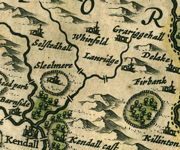
gazetteer links places may or may not be labelled on the map |
||

|
-- Docker Bridge |
|
|
|
-- Grayrigg Hall -- "Grariggehall" |
|
|
|
-- Kent, River |
|
|
|
-- Lambrigg Beck (?) |
|
|
|
-- Lambrigg Park |
|
|
|
-- Lambrigg -- "Lanridge" |
|
|
|
-- Laverock Bridge |
|
|
|
-- Mint, River |
|
|
|
-- Old Park |
|
|
|
-- Patton Bridge |
|
|
|
-- Selside Hall -- "Selstedhall" |
|
|
|
-- Skelsmergh Hall Farm -- "Sleelmere" |
|
|
|
-- Whinfell -- "Whinfeld" |
|
|
civil parishes The area roughly includes parts of parishes:- Skelsmergh Scalthwaiterigg Longsleddale Firbank Lambrigg Strickland Roger Docker Kendal Old Hutton and Holmescales Grayrigg Helsington Underbarrow and Bradleyfield Whitwell and Selside Killington Natland New Hutton Strickland Ketel Whinfell |
||
|
|
||
|
|
Lakes Guides menu. | |