 Jansson 1646 NY46


|

|
|
|
gazetteer links places may or may not be labelled on the map |
||

|
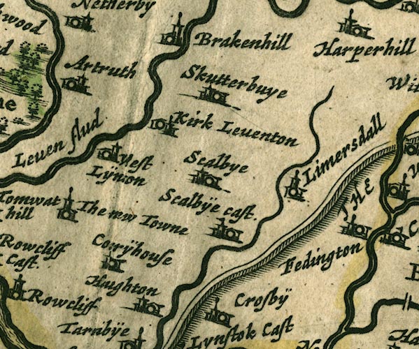
-- Arthuret -- "Artruth" |
|
|
|
-- Brackenhill Tower -- "Brakenhill" |
|
|
|
-- Corry House -- "Corrÿhouse" |
|
|
|
-- Hadrian's Wall -- "THE PICTS WAL." -- "THE
PICTS WAL." |
|
|
|
-- Houghton -- "Haughton" |
|
|
|
-- Irthington -- "Fedington" |
|
|
|
-- Kirklinton -- "Kirk Leventon" |
|
|
|
-- Laversdale -- "Limersdall" |
|
|
|
-- Low Crosby -- "Crosbÿe" |
|
|
|
-- Newtown of Rockcliffe -- "The new Towne" |
|
|
|
-- Scaleby Castle -- "Scalbÿe cast." |
|
|
|
-- Scaleby -- "Scalbye" |
|
|
|
-- Skitby -- "Skutterbuye" |
|
|
|
-- Westlinton -- "West Lÿnton" |
|
|
civil parishes The area roughly includes parts of parishes:- Irthington Westlinton Arthuret Stanwix Rural Brampton Scaleby Walton Stapleton Kirklinton Middle Hethersgill |
||
|
|
||
|
|
Lakes Guides menu. | |