 Jansson 1646 NY25


|

|
|
|
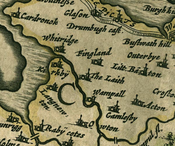
gazetteer links places may or may not be labelled on the map |
||

|
-- Aikton -- "Acton" |
|
|
|
-- Drumburgh Castle -- "Drumbugh cast" |
|
|
|
-- Fingland -- "Fingland" |
|
|
|
-- Gamelsby -- "Gamelsby" |
|
|
|
-- Hadrian's Wall -- "THE PICTS WAL." -- "THE
PICTS WAL." |
|
|
|
-- Kirkbride -- "Kirkbÿ" |
|
|
|
-- Laythes -- "The Laith" |
|
|
|
-- Little Bampton -- "Litt. Ba~ton" |
|
|
|
-- Newton Arlosh -- "Langnewton" |
|
|
|
-- Oulton -- "Owton" |
|
|
|
-- Raby Cote -- "Rabÿ Cotes" |
|
|
|
-- Wampool -- "Wampall" |
|
|
|
-- Whitrigg -- "Whitridge" |
|
|
civil parishes The area roughly includes parts of parishes:- Rockcliffe Aikton Kirkbride Kirkbampton Burgh by Sands Thursby Waverton Woodside Holme East Waver Dundraw |
||
|
|
||
|
|
Lakes Guides menu. | |