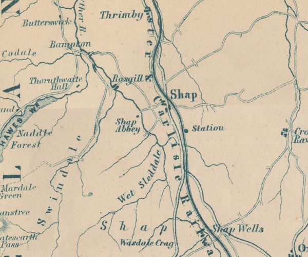
 Garnett 1850s-60s NY51


|

|
|
|
gazetteer links places may or may not be labelled on the map |
||

|
-- Bampton -- "Bampton" |
|
|
|
-- Cawdale Beck |
|
|
|
-- Lancaster and Carlisle Railway -- "Lancaster & Carlisle
Railway" -- "Lancaster & Carlisle Railway" |
|
|
|
-- Kendal to Shap |
|
|
|
-- Shap to Penrith |
|
|
|
-- Rosgill -- "Rosgill" |
|
|
|
-- Shap Abbey -- "Shap Abbey" |
|
|
|
-- Shap Station -- "Station" |
|
|
|
-- Shap Wells Hotel -- "Shap Wells" |
|
|
|
-- Shap -- "Shap" |
|
|
|
-- Sleddale Beck |
|
|
|
-- Swindale Beck |
|
|
|
-- Swindale -- "Swindale" |
|
|
|
-- Thornthwaite Hall -- "Thornthwaite Hall" |
|
|
|
-- Wet Sleddale -- "Wet Sleddale" |
|
|
civil parishes The area roughly includes parts of parishes:- Newby Shap Little Strickland Sleagill Bampton Shap Rural Longsleddale Crosby Ravensworth Thrimby Lowther |
||
|
|
||
|
|
Lakes Guides menu. | |