 Garnett 1850s-60s NY25


|

|
|
|
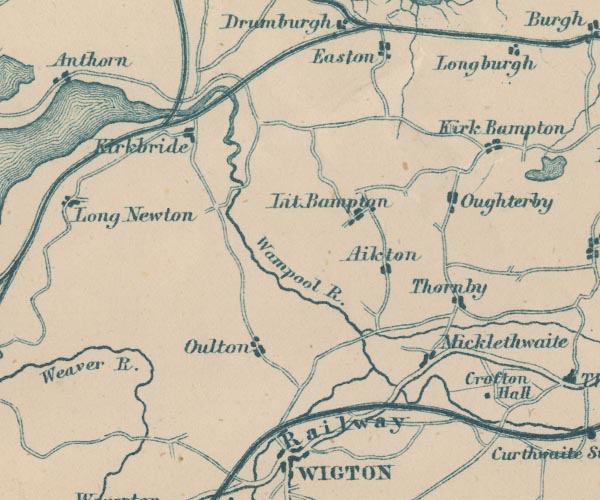
gazetteer links places may or may not be labelled on the map |
||

|
-- Aikton -- "Aikton" |
|
|
|
-- Crofton Hall -- "Crofton Hall" |
|
|
|
-- Kirkbampton -- "Kirk Bampton" |
|
|
|
-- Kirkbride -- "Kirkbride" |
|
|
|
-- Little Bampton -- "Lit. Bampton" |
|
|
|
-- Maryport and Carlisle Railway -- "Whitehaven Maryport &
Carlisle Railway" |
|
|
|
-- Micklethwaite -- "Micklethwaite" |
|
|
|
-- Oughterby -- "Oughterby" |
|
|
|
-- Oulton -- "Oulton" |
|
|
|
-- Port Carlisle Dock and Railway |
|
|
|
-- Solway Junction Railway |
|
|
|
-- Thornby -- "Thornby" |
|
|
|
-- Wampool, River -- "Wampool R." |
|
|
civil parishes The area roughly includes parts of parishes:- Rockcliffe Aikton Kirkbride Kirkbampton Burgh by Sands Thursby Waverton Woodside Holme East Waver Dundraw |
||
|
|
||
|
|
Lakes Guides menu. | |