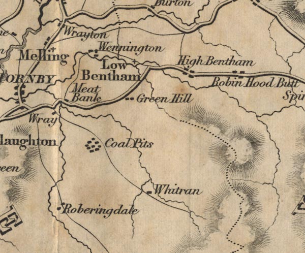
 Ford 1839 map SD66


|

|
|
|
gazetteer links places may or may not be labelled on the map |
||

|
-- Butt -- "Robin Hood Butt" |
|
|
|
-- coal mine, Wray with Bolton -- "Coal Pits" |
|
|
|
-- Green -- "Green Hill" |
|
|
|
-- High Bentham -- "High Bentham" |
|
|
|
-- Low Bentham -- "Low Bentham" |
|
|
|
-- Mealbank -- "Meat Bank" |
|
|
|
-- Roeburndale -- "Roberingdale" |
|
|
|
-- Wennington -- "Wennington" |
|
|
|
-- Whitray -- "Whitran" |
|
|
|
-- Wray -- "Wray" |
|
|
counties The area includes parts of counties:- Lancashire North Yorkshire |
||
|
|
||
|
|
Lakes Guides menu. | |