 Ford 1839 map SD09


|

|
|
|
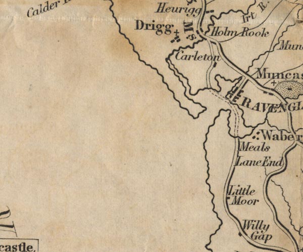
gazetteer links places may or may not be labelled on the map |
||

|
-- Carleton Hall -- "Carleton" |
|
|
|
-- Drigg -- "Drigg" |
|
|
|
-- Eskmeals House -- "Meals" |
|
|
|
-- Holmrook -- "Holm Rook" |
|
|
|
-- Lane End -- "Lane End" |
|
|
|
-- Little Moor -- "Little Moor" |
|
|
|
-- Ravenglass -- "RAVENGLASS" |
|
|
|
-- Broughton to Ravenglass -- "R to B 11 Ms." |
|
|
|
-- Ravenglass to Egremont -- "E to R 13 Ms." |
|
|
civil parishes The area roughly includes parts of parishes:- Drigg and Carleton Muncaster Seascale Waberthwaite Irton with Santon Bootle |
||
|
|
||
|
|
Lakes Guides menu. | |