 Ford 1839 map NY75


|

|
|
|
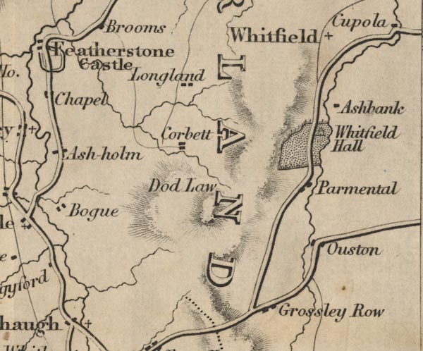
gazetteer links places may or may not be labelled on the map |
||

|
-- Ashybank -- "Ashbank" |
|
|
|
-- Garbutt Hill -- "Corbett" |
|
|
|
-- Grossley Row -- "Grossley Row" |
|
|
|
-- Humble Dod -- "Dod Law" |
|
|
|
-- Longland -- "Longland" |
|
|
|
-- Ouston -- "Ouston" |
|
|
|
-- Parmontley Hall -- "Parmental" |
|
|
|
-- Whitfield Hall -- "Whitfield Hall" |
|
|
|
-- Whitfield -- "Whitfield" |
|
|
civil parishes The area roughly includes parts of parishes:- Alston Moor |
||
|
|
||
|
|
Lakes Guides menu. | |