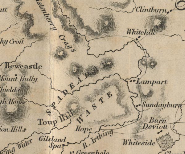
 Ford 1839 map NY67


|

|
|
|
gazetteer links places may or may not be labelled on the map |
||

|
-- Christianbury Crag -- "Christenberry Crags" |
|
|
|
-- Hope -- "Hope" |
|
|
|
-- Lampert -- "Lampart" |
|
|
|
-- Spadeadam Forest -- "SPADEADAM WASTE" |
|
|
|
-- Sundayburn -- "Sundayburn" |
|
|
|
-- Tip Hill -- "Toup Hill" |
|
|
|
-- Whitehill -- "Whitehill" |
|
|
civil parishes The area roughly includes parts of parishes:- Askerton Kingwater Bewcastle |
||
|
|
||
|
|
Lakes Guides menu. | |