 Ford 1839 map NY65


|

|
|
|
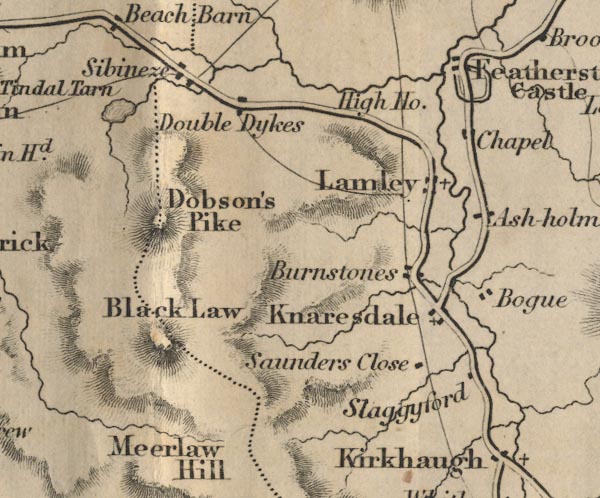
gazetteer links places may or may not be labelled on the map |
||

|
-- Ashholme -- "Ash holm" |
|
|
|
-- Bog, The -- "Bogue" |
|
|
|
-- Burnstones -- "Burnstones" |
|
|
|
-- Cold Fell -- "Dobson's Pike" |
|
|
|
-- Featherstone Castle -- "Featherstone Castle" --
"Chapel" |
|
|
|
-- Great Blacklaw Hill -- "Black Law" |
|
|
|
-- High House -- "High Ho." |
|
|
|
-- Knarsdale -- "Knaresdale" |
|
|
|
-- Lambley -- "Lamley" |
|
|
|
-- North Doubledykes -- "Double Dykes" |
|
|
|
-- Saunders Close -- "Saunders Close" |
|
|
|
-- Sibenese (?) -- "Sibeneze" |
|
|
|
-- Slaggyford -- "Slaggyford" |
|
|
|
-- Tindale Tarn -- "Tindal Tarn" |
|
|
civil parishes The area roughly includes parts of parishes:- Farlam Midgeholme Geltsdale Ainstable |
||
|
|
||
|
|
Lakes Guides menu. | |