 Donald 1774 NX9718F

|

|
|

|
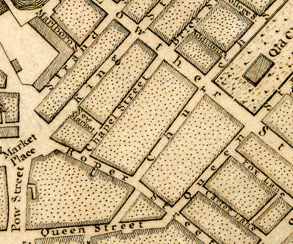
-- Addison Street -- "Addisons A." |
|
|
|
-- Carter Lane -- "Carter Lane" |
|
|
|
-- Chapel Street -- "Chapel Street" |
|
|
|
-- Church Street -- "Church Street" |
|
|
|
-- King Street -- "King Street" |
|
|
|
-- Low Market -- "New Market" |
|
|
|
-- Lowther Street -- "Lowther Street" |
|
|
|
-- Marlborough Street -- "Marlboro S." |
|
|
|
-- New Street -- "Brick Street" |
|
|
|
-- Queen Street -- "Queen Street" |
|
|
|
-- Roper Street -- "Roper Street" |
|
|
|
-- Strand Street -- "Strand Street" |
|
|
civil parishes The area roughly includes parts of parishes:- Whitehaven |
||
|
|
||
|
|
Lakes Guides menu. | |